I am delighted to share news of our financial support of Mapeia Brasil, an initiative of UMBRAOSM (União dos Mapeadores Brasileiros do OpenStreetMap) to improve road data in OpenStreetMap (OSM) for strategic cities in Brazil.
We kick off the collaboration by interviewing Raphael de Assis, President of UMBRAOSM, as the next installment in our OpenStreetMap interview series.
1. Who are you and what do you do? What got you into OpenStreetMap?
My name is Raphael de Assis, and I am an undergraduate student in Computer Networks at Faculdade Estácio de Sá. I am a member of the Communication Working Group of the OpenStreetMap Foundation and currently serve as president of UMBRAOSM – the Union of Brazilian OpenStreetMap Mappers. I work as a mentor in collaborative mapping projects, notably Mapeia Belém (2023–2024), which aimed to improve data for the city of Belém in preparation for COP30, and I am the creator of Mapeia Crato 2025. I also participated in coordinating the State of the Map (SOTM) Brazil 2023 in Curitiba
My interest in OpenStreetMap began in 2016 when I noticed the lack of available data in the city of Recife/PE. This motivated me to become a volunteer for OSM and an advocate for open and free data in Brazil, aiming to make mapping more accessible, complete, and useful for everyone.
2. What is the Mapeia Brasil project? Who is involved?
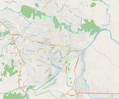
Mapeia Brasil is a collaborative community mapping initiative aimed at improving the quality and coverage of geographic data in Brazilian cities.
_The main focus is the updating and correction of street names using official data from IBGE, especially from the 2022 Census. These efforts aim to make essential information more accessible for urban mobility, accessibility, planning, and citizenship services.
The project seeks to engage volunteers and local communities, training people with no prior mapping or technology experience, and encouraging the creation of local mapper groups in various regions of the country.
Key participants include:
-
Volunteers from the OpenStreetMap community across multiple Brazilian cities.
-
UMBRAOSM – Union of Brazilian OpenStreetMap Mappers, providing training and support to the participating mappers.
-
Specific projects such as Mapeia Belém and Mapeia Crato, which serve as references for the methodology and impact of the project.
To learn more about the Mapeia Brasil project, follow the cities that will be updated during the initiative, and contact the organizers, visit the official website.
3. What are the unique challenges and joys of mapping in Brazil?
Brazil is a continental country with a wide diversity of urban and rural realities. This makes keeping maps up to date in all regions a significant challenge. Many municipalities still lack quality open data about streets, ZIP codes, neighborhoods, or public facilities, which makes mapping a more manual and collaborative task.
Additionally, Amazonian, quilombola, indigenous, and riverside regions have limited coverage, requiring adapted methodologies and cultural sensitivity. Urban contexts also pose challenges: many Brazilian cities have unnamed streets, irregular house numbering, recent settlements, and rapidly changing urban spaces.
On the other hand, mapping Brazil is also an enriching experience. It captures everything from complex metropolises to small villages, passing through unique biomes like the Amazon, Cerrado, Pantanal, and Caatinga. Mapping can support residents in advocating for improvements such as lighting, transportation, sanitation, and healthcare, functioning as a true tool of citizenship.
Brazil also has a very active OpenStreetMap community that develops local solutions, apps, and impactful projects. Examples include Mapeia Belém (2023), Mapeia Crato (2025), and the “mapatonas” promoted by UMBRAOSM in 2023 and 2024, which in 2025 will advance building mapping across multiple cities in Brazil. There is immense satisfaction in seeing the map grow through your own contributions, knowing that this collective effort benefits thousands of people nationwide.
Thus, the biggest challenge is dealing with the country’s size, information inequality, and limited infrastructure. The greatest joy is seeing mapping established as an instrument of social, cultural, and civic transformation.
4. What would make this project a great success for you?
The project would be a great success if the OpenStreetMap Foundation could provide micro-grants and volunteer training, allowing people from various regions of Brazil to participate actively. This would help communities create local mapper groups, strengthening regional engagement.
Additionally, global visibility for the project could attract other OSM partner organizations, expanding support for this initiative, which aims to improve data in 13 Brazilian cities. Consequently, these regions would have updated information, directly benefiting residents who could use it for urban mobility, accessibility, online shopping, and other daily activities.
5. What is the best way for people to do something similar in their region?
The best way to start is small and collaboratively. Each community can identify which information is most relevant to daily life—unnamed streets, public facilities, points of interest, or community services.
The first step is to use OpenStreetMap, an open and free platform, to map neighborhoods, villages, and cities. You can start with simple elements like streets, squares, schools, and health clinics.
It is also essential to organize the local community, creating volunteer groups and involving schools, universities, neighborhood associations, and collectives. To engage more people, hosting in-person or online mapathons is effective.
Training is also important: using guides, tutorials, and workshops, as well as offering continuous support for beginners through mentorship.
Forming partnerships with UMBRAOSM – the Union of Brazilian OpenStreetMap Mappers, an organization that trains new mappers and maps invisible areas, is crucial. This work gives visibility and dignity to people living in these regions, further strengthening the initiative.
Finally, it is essential to focus on social relevance. Choose themes with real impact, such as mobility, accessibility, environment, health, or infrastructure, and show that mapping is not just “drawing on a map” but a powerful tool for citizenship.
The secret is simple: unite people around a common cause, use open tools like OSM, and transform the map into a living reflection of the community’s needs and potential.
6. What measures could the global OpenStreetMap community take to help support mapping projects like this and the Brazilian OSM community?
The global OpenStreetMap community can play an important role in strengthening initiatives like Mapeia Brasil and directly supporting the Brazilian mapping community.
Some key measures include:
-
Promoting knowledge exchange through training, webinars, and workshops led by global experts.
-
Creating mentorship networks between experienced mappers and new volunteers in Brazil.
-
Highlighting Brazilian initiatives internationally on OSM official channels and events such as State of the Map.
-
Supporting social impact projects, such as mapping invisible areas led by UMBRAOSM, showcasing them as examples of community transformation.
-
Providing micro-grants, community funds, or sponsorships for workshops, mapathons, and local initiatives.
-
Recognizing and supporting UMBRAOSM for its crucial role in training new mappers and mapping invisible areas, giving visibility and dignity to historically neglected populations.
7. Last year, OpenStreetMap celebrated 20 years. Where do you think the project will be in 20 years, both in Brazil and globally?
Globally, in 20 years, OpenStreetMap will likely be a universal, real-time platform integrating street data, transportation, infrastructure, risk areas, and environmental changes.
In Brazil, the country will have detailed coverage of cities and rural areas, including peripheries and historically invisible regions on maps, thanks to collaborative initiatives like Mapeia Brasil and the work of UMBRAOSM.
Mapping will be a tool for citizenship, allowing communities to influence public policies, advocate for improvements, and actively participate in urban planning.
The Brazilian OSM community will be an international reference, integrating humanitarian, academic, and technological projects, and demonstrating the social impact of collaborative mapping.
Thank you, Raphael and everyone adding to OpenStreetMap in Brazil. We are proud to be able to play a small part in the project.
Happy mapping (whether in Brazil or elsewhere),
Please let us know if your community would like to be part of our interview series here on our blog. If you are or know of someone we should interview, please get in touch, we’re always looking to promote people doing interesting things with open geo data.