Hi everyone,
A few days ago we opened up our new spreadsheet geocoding service up to the public!
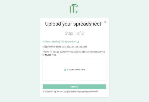
You can test the service in your OpenCage account dashboard, in the “Geocodng Spreadsheets” section.
We are considering this a “public beta”. There are still some rough edges and some work to be done to deal with strange edge cases. But many people are now using the service successfully.
Free trial user can upload spreadsheets of up to 100 rows, while customers can upload files with up to 10,000 rows.
There is a detailed tutorial explaining the process of geocoding a spreadsheet.
As you may guess, how well we are able to process your file depends a lot on how your data is formatted. We have written a guide to spreadsheet formatting with examples of common mistakes and misunderstandings.
Many thanks to everyone who tested the service when it was in private beta. We have learned a lot in the last few months, and no doubt we will find more things to fine-tune in the coming weeks. So don’t be surprisd if the product continues to evolve.
In that spirit, we welcome any and all feedback you may have about the service (positive or negative).
Happy geocoding, whether via our API or by uploading a spreadsheet
Ed