In this edition of our OpenStreetMap interview series, we spoke with Sofia Pahaoja, creator of Touch Mapper, a project that uses OpenStreetMap data and 3D printing to create tactile maps for visually impaired people.
1. Who are you, what do you do, and how did you first get involved with OpenStreetMap?
I’m Sofia Pahaoja, a Finnish software engineer. I’ve been programming since I was young. I’d known about OpenStreetMap for a long time, but hadn’t used it much until I started working on Touch Mapper about ten years ago.
2. Can you tell us about Touch Mapper and what inspired you to create it? How did OpenStreetMap and 3D printing come together in the idea behind the project?
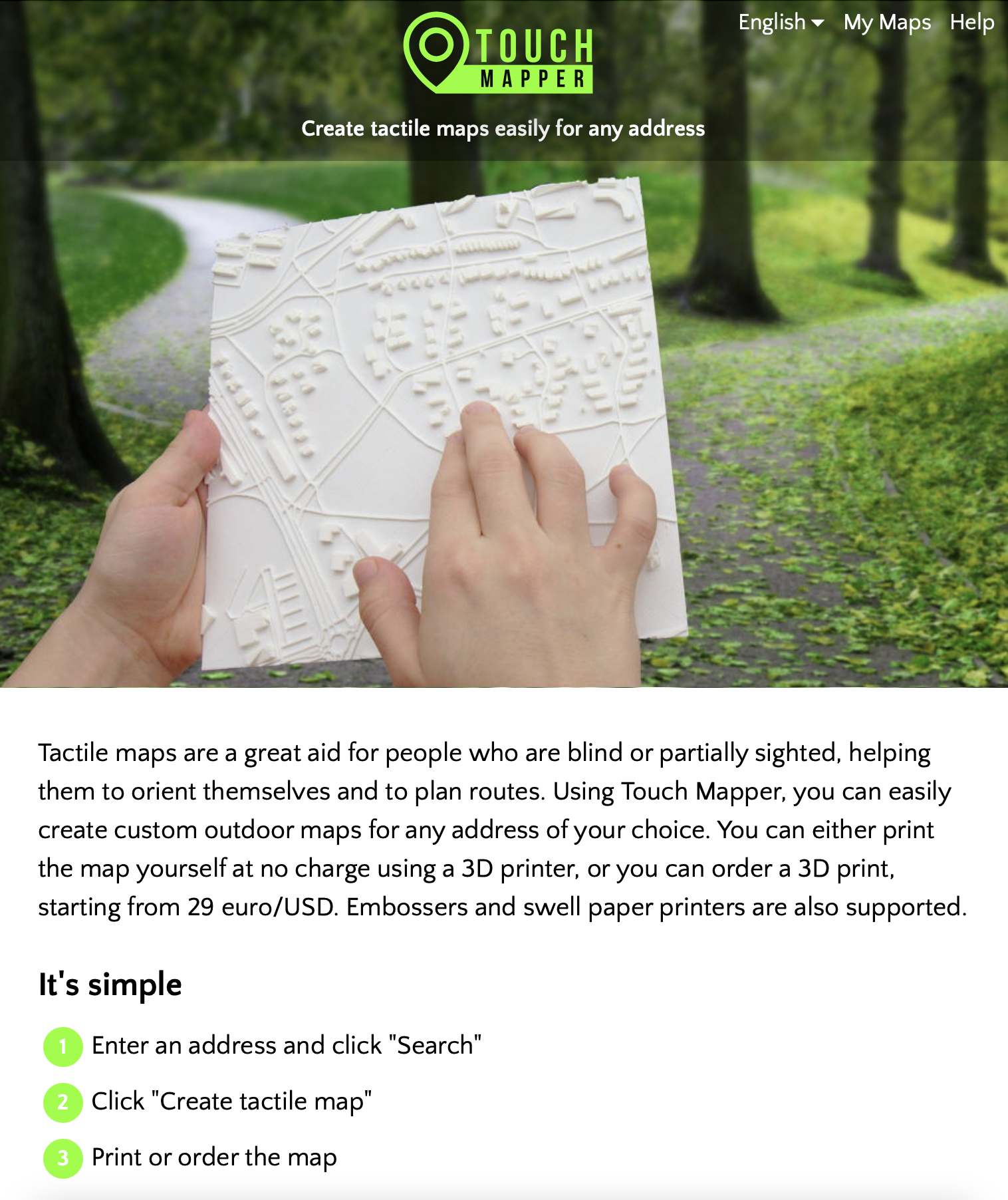
Touch Mapper is a website where you can create tactile maps for visually impaired people for free, if you print them yourself. Both 3D printing and embossing on paper are supported.
I created Touch Mapper because my partner was visually impaired, and spending time with her made me realize that there were virtually no usable tactile maps for that group of people, and that creating them from OpenStreetMap data wouldn’t be that difficult.
We were on vacation in Rome, and I wanted to explain to her the layout of the neighborhood around our hotel. But words couldn’t really convey it. About all I could say was, “It’s a maze of narrow streets.” There are simply no substitutes for a map, be it visual or tactile.
For many visually impaired people, being able to explore an area using a map offers an entirely new way of understanding their surroundings. A tactile map can be extremely useful in practical ways, but it can also offer the same joy that anyone might get from studying a map out of curiosity.
She was enthusiastic about the idea of Touch Mapper and played an important role in testing it throughout the initial development.
As far as I knew, there weren’t any other practical sources of map data besides OpenStreetMap. Google Maps existed, of course, but it didn’t offer the same access to reusable geographic data that I needed.
3. Touch Mapper uses OpenStreetMap data to create tactile 3D-printed maps. What makes OSM particularly well suited to this kind of accessibility project?
Besides being one of the few practical sources of map data, OSM has an important advantage: anyone can improve it.
Most maps generated using Touch Mapper are created by professionals who work with visually impaired people. If they find that important information is missing, they can add it to OpenStreetMap and then generate the map they need.
4. What have you learned about OpenStreetMap through working with it for Touch Mapper? Are there particular features or types of map data that are especially important when creating maps for people who are blind or partially sighted?
OpenStreetMap contains a wealth of information. Pedestrian paths are generally more important than roads for tactile maps, and sometimes those are missing. Pedestrian crossings are also important, but aren’t always mapped.
Another lesson has been that the geometry described by OSM isn’t always suitable for 3D printing. Roads and buildings can overlap, or the data may contain geometries that simply don’t make sense.
A visual map can tolerate all kinds of geometric imperfections, because it’s ultimately just drawing shapes on a screen. But a 3D-printed map needs to consist of physically valid, printable solids. Overlapping shapes, tiny gaps, and other geometric inconsistencies can cause problems when generating a printable model.
In practice, most of these issues can be handled automatically, but it requires treating the data as something that may need cleanup, and using heuristics to make tiny adjustments to the geometry.
5. You mention that missing buildings and other inaccuracies in OSM can affect the resulting maps. What challenges have you encountered with OSM data, and what could the OSM community do to make the map more useful for accessibility applications?
Generally, the biggest problem is simply missing data, whether that’s buildings, roads, or pedestrian paths. Users rarely complain about this, though. My impression is that they don’t expect the underlying map data to be perfect.
One important limitation is indoor mapping. Many practical needs of visually impaired people involve navigating indoor spaces, such as finding a particular store in a shopping mall.
Indoor spaces would probably require a rather different approach to tactile map creation. My impression is that the indoor mapping data available in OSM isn’t yet complete or consistent enough to make this a worthwhile addition to Touch Mapper, though I haven’t investigated the matter very thoroughly.
6. Touch Mapper shows one interesting way that OpenStreetMap data can be used beyond a traditional digital map. What other possibilities do you see for OSM in accessibility, tactile mapping, or other applications that the community might not have considered?
A recent addition to Touch Mapper is textual description of the selected area. This enables a visually impaired person to verify that they have selected the correct area for the map. But it could also answer questions such as “What points of interest are there near my home or place of work?”
Chatbots could also be an excellent interface for visually impaired people. Their text-based interfaces work well with screen readers and braille displays, allowing people to ask questions in natural language.
I’m not sure how much access chatbots currently have to OSM data, but questions like “Describe the walking route from my home to this bus stop”, “List the most important points of interest near this address”, or “Is there a park between the station and the library?” could benefit enormously from having API access or another way of querying structured OSM data.
Imagine a blind person who has just moved to a new neighborhood. They could ask a chatbot what’s around their new home, where the nearest shops and parks are, and how the streets connect to each other. They could then ask follow-up questions, gradually building a mental picture of the neighborhood without ever needing to see a map.
This would go beyond simply giving directions from one place to another. It would make exploring and understanding the geography of a place a much more accessible experience.
7. Looking ahead, what would you like to see happen with Touch Mapper and OpenStreetMap over the next 10–20 years, particularly in making geographic information more accessible to people with different needs?
Indoor maps, definitely. Finding your way around a shopping mall, an airport, or a university building can be very difficult without sight, and having good indoor map data could make a huge difference.
Routing is another possibility: step-by-step walking directions designed specifically for visually impaired people. This requires more than just knowing where the streets and paths are. Information about pedestrian crossings, stairs, entrances, and other details can be essential.
More broadly, I’d like to see geographic information become something everyone can explore, regardless of how they perceive the world. Maps are traditionally visual, but the underlying information doesn’t have to be presented visually. It can be turned into tactile maps, spoken descriptions, or interactive conversations.
I hope that in 10 or 20 years, a blind person will be able to explore an unfamiliar city with much the same freedom and curiosity as a sighted person looking at a map. OpenStreetMap could provide much of the data needed to make that possible.
Thank you, Sofia! It’s inspiring to see how OpenStreetMap can help make geographic information more accessible and give visually impaired people new ways to explore and understand the world around them.
Please let us know if your community would like to be part of our interview series here on our blog. If you are or know of someone we should interview, please get in touch, we’re always looking to promote people doing interesting things with open geo data.