In this edition of our interview series with OpenStreetMap communities around the world, I chat with Andrés Gómez and Juan Arellano - two of the organizers of the 2025 State of the Map Latin America, coming up in Medellín, Colombia, from September 4th to 6th.
1. Who are you and what do you do? What got you into OpenStreetMap?
I am Andrés Gómez, a systems engineer from Colombia. I have been working with data all my professional life, specifically as a Db2 DBA in different industries. I studied a Master’s in Software Engineering in France, and after that, I had the opportunity to work in Lyon. At the Computing Center of the National Institute of Nuclear Physics and Particle Physics - CC-IN2P3, I started to work and contribute to many open-source software projects, and thanks to my friend Jonathan Schaeffer, I discovered a lot of movements around open data and culture. It was 2009 when I arrived at OpenStreetMap, a young project about mapping, and it caught my attention. I initially started contributing alone, gradually understanding the significance of the project on my own.
In Colombia, in 2015, I started to contribute a lot. Because of the 2020 lockdown, I wanted to do more, but I had to stay home. That’s how I began to solve notes, and I met Rafael Isturiz, with whom I solved a lot of notes while doing some events. He called these events “notathons”, and they helped to integrate Latin America into OSM.
Hi, I am Juan Arellano, a former programmer from Lima, Peru, now living in Medellín, Colombia. I learned about OSM when working for Global Voices, a community of writers, translators, and human rights activists. Years later, I started volunteering for the OSM Foundation, translating blog posts. This led me to be in contact with the mapping community and then to HOTOSM, where I currently work. 2017 I attended a State of the Map in Lima, but this event stopped happening in 2019 in Latin America. Fast forward to 2023. In the AbreLatam conference in Montevideo, I heard the FOSS4G 2024 was going to happen in Belem, Brazil, so I approached the person who had given the notice to ask if she thought it was feasible to hold a SOTM in conjunction with FOSS4G, as had happened on other occasions. She said yes, and that we could talk about it. That’s how I embarked on organizing a State of the Map.
2. What would you say is the current state of OpenStreetMap in Latin America? What is working well? What needs to improve? What unique aspects of mapping in the region should the rest of the world know about?
OSM communities in Latin America used to be very involved in their areas, but the first generation did not take care of the generational change. These initial participants contributed a lot, and we still have good maps thanks to them, but many of them are no longer working in OSM. So, many communities do not have continuity, and we have had to push them again to go along with new contributors and show all the possibilities.
“Notathons” have helped revive communities, reactivate social networks, and create more events. Also, the HOTOSM lac hub has helped develop activities, recognize people, spread the word about OSM in many organizations, and react against disasters.
Latam is very active in 2025 compared to five years ago. However, we still do not have communities in some Caribbean countries; some communities are shy and don’t communicate much. However, many of our events try to encourage, and SotM LatAm allows us to meet personally and create stronger ties between countries.
The language is something that helps us to integrate, because Spanish is spoken from Mexico to Argentina. Also, Portuguese is an essential language in the region and is close to Spanish, so we speak “Portuñol” (Portugués and Español) between us. Another aspect that helps us to have a strong community is our history. First, these areas were populated by Indigenous peoples, and then the Spanish and other Europeans arrived. So we have similar architecture, legal principles, culture, cities, etc. Then, it was the independence of all these countries, and now we follow a similar structure (sometimes chaotic for others).
We have many things in common, and we are third-world countries (countries that did not participate in the Cold War or the Second World War). This helps us integrate into this vast area of the Andean mountains, the Amazon, and the Caribbean.
We still need to improve many aspects of the community. One of them should be to have a better presence in the international community. Some software developments are made by Latin American people but are not known as such. Some mapping projects in the region may not be as big as in other areas, but they have particular challenges from which people from different countries could learn. We need to communicate better.
3. Thanks for organizing the conference. Who should attend? What can attendees expect? Is there anything special planned?
Last year, we organized the State of the Map Latam again. We had a five-year pause for different reasons, and COVID-19 didn’t help. But Juan Arellano is very involved in this, leading the event, and we are creating an even better conference.
We are inviting everyone, even if the event is in Latin America, everyone is welcome. Last year, we had representatives from many non-Latin American countries, which helped everyone see the potential of OSM in the world. People from Japan, Europe, or the USA showed us what they are doing, and we showed them our work, and that created ties between continents, opening the doors for new projects, businesses, and opportunities.
We had some academic conferences last year and are working harder to develop a better academic track this year. As can be seen from our LinkedIn page, Latin America has a strong educational community, and having a track like this allows them to show their work or to start using OSM as a tool for their research.
I want to share something we did at the previous SotM LatAm. We started our event by gathering data on the field, with 360 cameras, people taking photos with Mapillary, creating notes, and answering StreetComplete quests. This was an excellent way for participants to know each other and have a better experience during the rest of the event.
This year, we are going to do something similar, and we are going to integrate the local community of Medellín. We have seen that this kind of conference happens in a city, but sometimes, the city does not receive anything from all these OSM experts. We want to change that and use feedback and experience from the conference participants to improve the local map—something like an imprint on the map where all these mappers gathered together.
One particular thing is that we are empowering the young and inviting newcomers to the events. This is creating traction in universities by generating interest in the map and the territory, which is helping the generational change. This year, we expect students or young graduates to participate in the event.
Finally, we have prepared extra activities that will surprise the participants. We invite the OSM community to Medellín, Colombia, to enjoy all the activities we have prepared for you.
4. What would make you and the other organizers say the conference was a big success?
This is the first time a SotM Latam will be held in Colombia. This reflects that the colombian community is getting stronger, which is already a big success. In addition, the old and new mappers will come, strengthening the relations between different generational groups.
The organization team is from several countries, and for the SotM Latam, we reuse many elements defined in the previous SotM Latam. We have democratic decisions and good communication channels, allowing us to have more structured responsibilities and a better and more organized event.
Sponsors play a crucial role in making the event possible, and having returning sponsors is a testament to its success. Having the same sponsor in consecutive events means they are happy with the results and investment. TomTom has already confirmed that they will sponsor us this year, and we are talking with other sponsors. I invite other organizations to sponsor this event and have a space to communicate with the community and expand their projects.
5. How can the rest of the world best help the Latin American OSM community?
OSM Latam is open to new projects and adventures. We have active people interested in using new apps or applying new mapping techniques. We also have developers interested in collaborating to develop new tools and platforms.
One barrier is language. Not everyone speaks English, and new projects, applications, and websites should be multilingual to allow access to them. Also, these new projects should enable new translations to adapt the text to our context. For example, OneStop was initially only in German, and we were the first to propose a translation into Spanish.
6. Last year OpenStreetMap celebrated 20 years. Where do you think the project will be in Latin American in another 20 years?
Many things in the OSM ecosystem have changed in the last twenty years. We created the Latam community, consolidated the map’s basic elements of our countries, and created communication channels and recurrent events. OSM contributors from civil society did all these, but very few from organizations.
In the next 20 years, OSM could play a more critical role in organizations that rely on GIS. Official institutions or well-established companies will be more interested in having a well-formed OSM community to develop their projects. In this way, all kinds of organizations, such as start-ups, governments, or multinationals, will promote the use and contribution to OSM.
With the advancement of AI, mapping from satellite imagery will be automatic; we already use several projects around this. But we will need drones to get higher-resolution images. OSM communities will coordinate the flight of these drones, capture photos, and control automatic mapping. Also, street-level photos will be more popular, and new photos will be automatically translated into map changes. So, communities will have to coordinate the on-ground data collection.
Also, communities should be official local chapters that represent OSM in our territories. The community members should start talking between them and define legal entities to represent the map.
The map will be very detailed in 20 years. But at that point, notes will be even more critical. Notes will be the feedback mechanism: a new store was opened there, the surface of a highway was repaved, or a tree was cut down. Non-OSM mappers will provide this information, with not only text notes but including images, audio, and video, and resolving them will be easier.
Thank you, very much Andres and Juan. For taking the time for speaking with us, andfor your efforts on behalf of the OpenStreetMap community. It is exciting to see the Latin American community re-gaining momentum, and no doubt this year’s conference will be an important milestone for the community. I encourage everyone who can to take part.
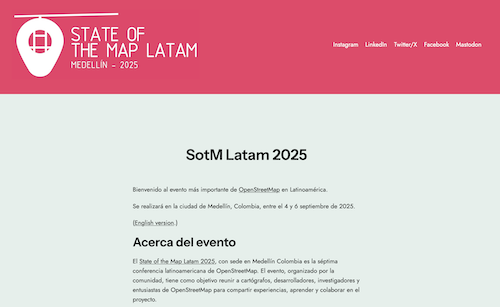
Learn more by checking out the State of the Map Latin America 2025 website, where you can find links to all of their social media.
Happy mapping, whether in Latin America or elsewhere
Please let us know if your community would like to be part of our interview series here on our blog. If you are or know of someone we should interview, please get in touch, we’re always looking to promote people doing interesting things with open geo data.