It’s a pleasure to welcome Christian Quest of the French Geographic Institute back to our OpenStreetMap interview series. Our last conversation with him dates all the way back to 2015. Since then, both OpenStreetMap and his work with Panoramax have evolved significantly, and we’re glad to revisit his insights at this important moment.
1. Who are you and what do you do? What got you into OpenStreetMap?
I’m Christian Quest, almost 60, currently working at IGN (French Geographic Institute) on Panoramax.
My first contact with OpenStreetMap was in 2009, when I signed in. Then I became a founding member of OpenStreetMap France, in 2011 and a board member for 11 years. I’m still maintaining a large part of OSM-FR servers, including the OSM-FR Panoramax server and blurring API.
2. What is the proposed Panoramax foundation? What inspired you to create it?
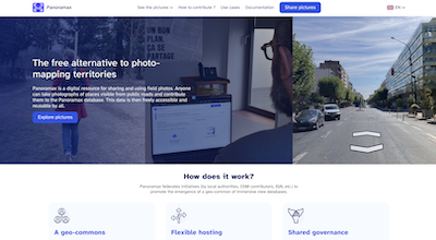
Panoramax is a project that started in 2022. OpenStreetMap France proposed to IGN to work together to build an open source, collaborative, decentralized and federated way of sharing ground level imagery. The idea was not new, I proposed something similar back in 2012!
After almost 4 years, it is time to setup a dedicated structure to take care of the project which cannot stay inside the French borders. We already have Panoramax servers in Taiwan, Wales, Spain, Croatia and several others should arise soon.
The OSM foundation is a source of inspiration, mainly on its light approach. OSMF takes care of the very core things (the main database, some basic services on top of it, and tools for the contributors), letting an ecosystem and local chapters build on that core to provide many additional services around OSM data.
I think the Panoramax foundation should also take care of the core of the project, like the meta-catalog that is federating the autonomous local Panoramax instances and some shared tools for contributors or to help set up new Panoramax instances.
Another thing the Panoramax foundation should take care is the coordination of the actual software stack development. This does not mean the foundation will do all developments, but it should make sure they fit a shared goal for the emerging Panoramax ecosystem.
3. What unique challenges or obstacles do you foresee in creating the Panoramax foundation?
The diversity of actors can be a source of challenge because we already have public services, local authorities, companies, not-for-profit structures and individuals involved in the project and their culture may be quite different.
Another source of challenge is the international aspect. We’ve been moving quite fast in France, but Panoramax is still not massively deployed outside of France.
4. The creation of the foundation is expected at the end of August during the annual OpenStreetMap conference. How can the OSM community get involved, and what types of contributions would be most helpful?
The SotM 2026 in Paris is an opportunity that we could not miss to extend Panoramax. We’ve been talking many times during the past years about creating a Panoramax foundation, setting the SotM 2026 as the birth of this foundation is pushing all the possible founding members to move forward before that date.
Some hardware, hosting and human resources will be needed. These can be donated to the foundation (hardware, hosting or human work time), and some may need to be funded. Funding can come from foundation membership fees, grants, donations, and other sources allowed by the law for non profit associations.
5. OpenStreetMap recently celebrated its 20th anniversary. As someone who has been active in OSM for years, where do you see the project in 20 years?
That’s a very difficult question to answer!
I see many challenges that we need to address… “data gardening” is my main concern. OSM needs more and more contributors to maintain the ever increasing amount of data.
Maybe more automation will be used to help gardening, but I’m also afraid of the AI trend if it is not viewed with enough objectivity.
We should continue to see OSM first as a community, then as a huge amount of data maintained by this community.
Thank you, Christian, for taking the time to speak with us again and share your perspective. It’s been great catching up after all these years, and we look forward to seeing how your work with Panoramax and OpenStreetMap continues to develop.
Danielle and the OpenCage team
Please let us know if your community would like to be part of our interview series here on our blog. If you are or know of someone we should interview, please get in touch, we’re always looking to promote people doing interesting things with open geo data.