In this edition of our OpenStreetMap interview series we speak with Martin Ždila of Freemap Slovakia, the Slovak local chapter of the OpenStreetMap Foundation. Founded in 2009 and run entirely by volunteers, the organisation promotes OpenStreetMap in Slovakia, develops the freemap.sk map portal, and helps improve national map data. In this interview, Martin shares insights into the Slovak mapping community, its achievements, and the challenges it faces.
1. Who are you and what do you do? What got you into OpenStreetMap?
Martin: We are Freemap Slovakia, the Slovak local chapter of the OpenStreetMap Foundation, established in 2009. Our main goals are to promote OpenStreetMap in Slovakia, to build and operate our own map portal freemap.sk, and to improve OSM data coverage — including negotiating access permissions and performing imports from open government sources. The organisation is run entirely by volunteers.
2. What would you say is the current state of OSM and the OSM community in Slovakia?
Martin: Slovakia has a small but technically skilled and dedicated community. On a typical day, around 10–20 mappers are active, and the top contributors are very prolific. Many active Slovak mappers are not yet members of Freemap Slovakia — if you map in Slovakia, we’d love you to join us! We’d also like to attract more mappers overall, especially from rural areas and smaller towns that are still less well covered.
Data coverage is strong for a country our size. Address coverage stands at around 96%, road networks and hiking trails are well-maintained, and we have excellent open government geodata to work with: the Ortofotomozaika SR provides high-resolution aerial imagery updated in regular cycles, and high-quality LiDAR data is publicly available — we actively use both for improving landcover, waterways, and terrain shading.
We also have a close relationship with the Czech OSM community — cross-posting in each other’s forums is common, and we jointly organise the annual State of the Map CZ+SK conference.
3. What are the unique challenges and pleasures of OpenStreetMap in Slovakia? What things should the rest of the world be aware of?
Martin: The landscape is a genuine pleasure to map — Carpathian mountain ranges, dense forests, thousands of kilometres of marked hiking and cycling trails, castles and historical sites. There is always something interesting to add or refine.
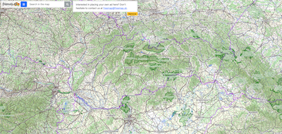
We are proud of www.freemap.sk — our non-commercial map portal built on OSM data, offering a detailed outdoor map for hiking, cycling, skiing, and horse riding across Central Europe. It includes marked trail overlays, route planning for many transport modes, a GPX track viewer, live tracking (OsmAnd, Locus, Traccar), offline map export, GPS device map downloads, and a community photo layer — available in seven languages. We also maintain LiDAR-based tooling for landcover tracing and waterway accuracy improvement.
On the challenge side, the open government data situation has been deteriorating. Our government has been gradually closing datasets that were previously freely available, and the cadastral office suffered a serious cyberattack with poor backups, slowing access to up-to-date cadastral data. This is a real concern for OSM in Slovakia going forward.
4. What is the best way to get involved? Is there a regular meet-up? A mailing list? Where does the community meet (in person and online)?
Martin: The best starting point is our Google Group:— technical discussions, import proposals, and mapping questions all happen there.
For news and updates we also have a Facebook page and a Mastodon account .
In person, we hold an annual general assembly once a year as a weekend gathering — talks, planning, and always some local mapping. A good chance for remote contributors to finally meet.
5. What steps could the global OpenStreetMap community take to help support OSM in Slovakia?
Martin: Anything that helps OSM globally helps Slovakia too — better tooling, broader public awareness, stronger core infrastructure.
One area worth highlighting specifically: the OSM tagging schema. Documentation for many tags is unclear or unfinished, and the same feature often has multiple competing tagging conventions. The community should be less afraid to clean up legacy tags and consolidate — AI tools could actually be a real asset here for auditing and rationalising tagging at scale.
6. OpenStreetMap recently celebrated its 20th birthday — a natural time to reflect on how far the project has come, but also to look forward. Where do you think the project will be in 10 years, both globally and in Slovakia specifically?
Martin: Globally? Hoping for OSM API 0.7 😄. More seriously, I expect OSM to become the default base layer for geospatial applications worldwide, with AI-assisted mapping accelerating coverage in under-mapped regions — though quality assurance and community governance will need to keep pace.
For Slovakia, I hope to see address coverage climb from ~96% toward complete, and a general improvement in precision across all feature types — landcover from LiDAR, more accurate waterways, better building footprints. The data is largely there; the next decade is about refining and deepening it.
Many thanks to Martin and the Freemap Slovakia team for taking the time to share their perspective and for the work they do supporting OpenStreetMap in Slovakia.
Forward!
Danielle and the OpenCage team
Please let us know if your community would like to be part of our interview series here on our blog. If you are or know of someone we should interview, please get in touch, we’re always looking to promote people doing interesting things with open geo data.