Our OpenStreetMap interview series continues with a chat with Laura Mugeha about OpenStreetMap in Kenya.
1. Who are you and what do you do? What got you into OpenStreetMap?
I am Laura Mugeha, a GIS analyst and developer in Nairobi, Kenya. I am also a Geospatial engineering student, YouthMapper and one of the co-ordinators for OSM Kenya, a local community for individuals interested in OpenStreetMap including organizations and YouthMappers chapters in the country. I found out about OpenStreetMap when conducting a research project and was looking for open spatial datasets in Kenya. I was fascinated by how one can contribute to the OSM project while supporting various humanitarian projects at the same time. OSM, being an open data initiative, allows users to contribute towards having more open datasets that would further enable scholars to conduct better research and governments and organizations to make data-driven decisions.
2. What would you say is the current state of OSM and the OSM community in Kenya?
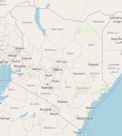
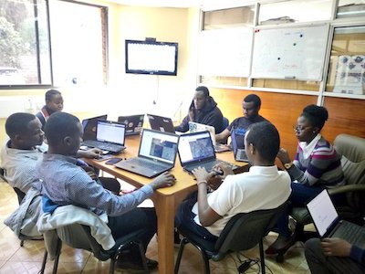
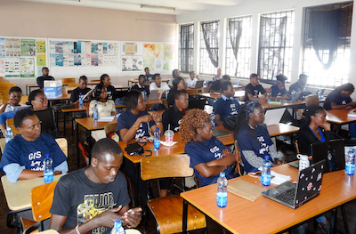
Several urban areas have been mapped on OSM in Kenya but we are now working towards achieving countrywide coverage by organizing for monthly mapathons and several training sessions to inform those interested on how they can contribute. In addition to this, we are also encouraging various organizations to use OpenStreetMap data in their projects and higher education institutions to include OSM in their curriculums through YouthMappers chapters. Our local community now has 100+ members and we keep growing every time we have a meetup. (We got 30 new mappers just on one day during this year’s Open Data Day Nairobi)
3. What are the unique challenges and pleasures of OpenStreetMap in Kenya?
A lot of regions in the country are constantly changing both positively and negatively and this means updating data on OpenStreetMap is key so that information on the map matches what is on the ground. This process means there is a need for high-resolution imagery; both temporal and spatial, that would enable editing on OpenStreetMap. We are hoping through collaborating with various satellite imagery providers and exploring various methods such as the use of drone imagery and ground mapping we will be able to achieve up-to-date data on OSM.
The use of OSM in the country is also limited mainly due to the lack of national coverage and awareness about the project generally but through our planned activities such as hackathons we hope to encourage the use of OSM to develop solutions to real-world challenges that we face locally.
4. What is the best way to get involved? How does the local community communicate, when and where do you meet?
The best way to get involved locally is by attending our monthly meetups and also contributing remotely to our projects. We currently have a slack channel and an active WhatsApp group where we share about events and any news, opportunities from the African and global OSM community. We also share our activities via Twitter. Our meeting venues change depending on availability but we have previously met at Ushahidi, RCMRD, YALI RLCEA and the University of Nairobi.
5. What steps could the global OpenStreetMap community take to help support OSM in Kenya?
The global OSM community can support us by contributing to our tasks remotely, collaborating with our community in various projects and offering assistance through impactful programs like the HOT microgrants.
6. This year OSM will celebrate its 15th birthday, so we are well into the “teenager” stage of the project. But what will it look likes when it “grows up”? Where do you think the project will be in 10 years time, both globally and in Kenya specifically?
Locally we believe we will have achieved full coverage of data on OSM and that there will be greater use of OSM data by various institutions especially government departments, NGOs and social enterprises in the country. Globally, I think there will be a rise in the number of OSM communities implying greater contribution and use of the data. There will also be better and easier ways to contribute to the project by incorporating new technological advancements such as AI & ML.
Many thanks, Laura. One of the many very positive trends around OSM in the last few years has beenthe emergence of strong national OSM communities across Africa. It’s been great to observe, and I think has many lessons for other parts of the world. I encourage everyone to get involved and support your efforts in Kenya.
Anyone who would like to stay informed should follow @OSMKenya on twitter.
happy mapping,
Please let us know if your community would like to be part of our interview series here on our blog. If you are or know of someone we should interview, please get in touch, we’re always looking to promote people doing interesting things with open geo data.