Hi everyone,
welcome to May 2022 #fridaygeotrivia!
As is our tradition, on the final Friday of month at 15:00 Berlin time / 14:00 London / 09:00 New York we run a geotrivia contest on twitter under the hashtag #fridaygeotrivia. Afterwards we post the answers here on the blog.
See below for how to play.
The May 2022 geotrivia question:
This month our question focuses on the endlessly fascinating topic of ISO 3166-1 alpha-2 codes, the two letter codes used to represent countries and territories.
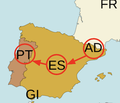
What is the longest chain of ISO 3166-1 alpha-2 codes in alphabetical order that you can put together in which the codes represent countries and territories that share a land border. As a basic example, say we start in Andorra (code: AD), and then go to Spain (ES) and then from there to Portugal (PT), we have an alphabetical chain of three ISO codes (AD -> ES -> PT).
Who can “discover” a longer chain? We’ll play for 90 minutes and the winner is whoever has the longest chain.
As always to get full points you will need emoji country flags and the hashtag #fridaygeotrivia in your answer.
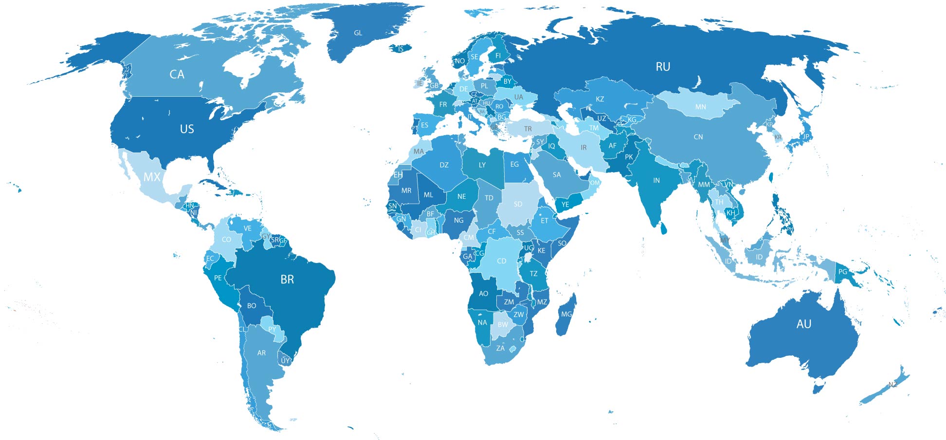
To help you on your way, you may find this world map of ISO 3166-1 Alpha-2 codes helpful.
Prizes
#fridaygeotrivia is a game with two prizes:
-
the sheer joy of geographic knowledge and pedantry.
-
the bragging rights of getting the answer first.
The winner
The prize was shared by Giorgio Comai and twitter user RyanKas4 who each independently discovered 7 country chains. Well done!
This month’s geotrivia answer:
- AO -> CD -> CF -> CG -> CM -> GA -> GQ
- AO -> CD -> CF -> CG -> CM -> NG -> TD
- DJ -> ER -> ET -> KE -> TZ -> ZM -> ZW
How to play
Anyone can join in, you just need a twitter account. Please note - these edition of the game was played long ago - these days we play on Mastodon, not twitter.
-
Reply to the question thread on twitter (previously embedded above, but twitter sadly broke embeds) using the hashtag #fridaygeotrivia in your answer.
-
Only one answer per tweet
-
While you can use a map, please do NOT use the internet to just search for an answer. That is cheating and will lead to seriously bad geokarma.
-
To get full points for an answer it is good form not just to name the relevant country but (if possible) to include the emoji flags of the country.
Some people have complained the format is a bit chaotic and hard to follow. Yes, the mad chaos is part of the fun. Embrace it. The goal is just to have fun and learn. We win by playing
Thanks for playing,