Hi everyone,
since we started OpenCage our geocoding model has been providing a simple-to-use API under the simple-to-understand model of “one location, one request, one response”.
This has worked very well.
But, the reality of the world is that not everyone is a software developer who feels comfortable working with an API. Much of the world holds their data in spreadsheets, and we are often approached by non-technical people asking if we can “geocode their spreadsheet”. We addressed this use case by providing an Excel plugin and a Google Sheets geocoding tutorial - two of the most popular spreadsheet formats. Recently we also released our tool for geocoding CSV files from the command line. Still, these tools are either too basic and in-flexible for many use cases, or had too high of a technical burden for some users.
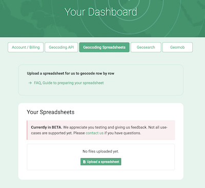
It was frustrating for both sides when we’ve had to turn these potential users of our service away. So, over the last few weeks we’ve been hard at work on a new interface to our service which allows uploading of a spreadsheet (an Excel or CSV file) containing addresses or coordinates which we then geocode, row by row.
We are now ready for beta testers of this new service. If you have some spreadsheets of addresses or coordinates, and would like to help us test the service, please get in touch.

Depending on the feedback we get from beta testers we will gradually roll out the service to all OpenCage users in the coming weeks, with a full “launch” scheduled for early 2025.
Happy geocoding, whether via our API or by uploading a spreadsheet
Ed