Hi everyone,
readers in the UK will be familiar with BBC’s Shipping Forecast a very long-running, regular (multiple times per day) weather report for areas of the sea surrounding the British Isles.
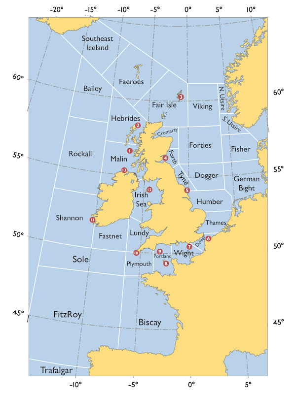
The water around Great Britain is divided into 31 sea areas, with a brief resport about wind speed, direction, rain or snow, and visibility. The unique (some would say cryptic) style and cadence of the shipping forecast has made it an iconic part of British culture. If you have never heard it you can listen to the most recent forecast (and past forecasts) over at Schuyler Erle’s delightful site gale8.net.
Here is a map showing the sea areas:
I am pleased to announce that we now attempt to return the relevant sea area as a part of the components section of geocoding results.
Here is an example for the coordinates 53.623, 2.450 in the North Sea:
         "components" : {
            "_category" : "natural/water",
            "_type" : "body_of_water",
            "body_of_water" : "North Sea",
            "shipping_forecast_sea_area" : "Humber"
         },
Geocoding the oceans is actually an interesting and often over-looked topic. We published #geoweirdness thread about it on our Mastodon account last year, if you would like to learn more.
Happy geocoding (and smooth sailing),