At OpenCage we believe in a lot of things. We believe that a combination of open source software and open data, especially open geo-data, means that your possibilities are limited only by the amount of hardware you can run on. We believe that multiple geocoders behind a simple RESTful API are better than one single standalone geocoder. We believe that you should be able to access a geocoder without writing a single line of code. We believe you should be able to see what a geocoding API does from your browser and from the command line. We believe that you should be able to easily access a geocoding API from your language of choice, be that PHP, Perl, Python, Ruby or any other language. We also believe in trying to live up to these beliefs.
That’s why the OpenCage team were in Karlsruhe in southwest German for the second Open Street Map State of the Map Europe conference, where we announced our OpenCage Geocoder to the OSM community at large. This geocoder is still in a beta stage right now but we’ve worked hard to try to make the geocoding API live up to our beliefs. This is how it stacks up.
We believe that multiple geocoders behind a simple RESTful API are better than one single standalone geocoder.
Check. The OpenCage geocoding API is an intelligent wrapper around the Nominatim, DataScienceToolkit, Twofishes and Nestoria geocoders. By themselves, each geocoder is a fine piece of work but like all things they have their strengths and their weaknesses. By putting them together behind a single API, we think that we can give you a better open geo-data geocoding experience.
We think of the OpenCage API as the tip of a geocoding iceberg; all you need to do is use the API without needing to worry about all the other geocoders under the metaphorical water line.
This isn’t the first time we’ve done this. Around 8 years ago Lokku, the company behind OpenCage, bootstrapped a Javascript API that wrapped multiple maps APIs behind a single API and in the process, helped start what would become Mapstraction.
We believe that you should be able to access a geocoder without writing a single line of code.
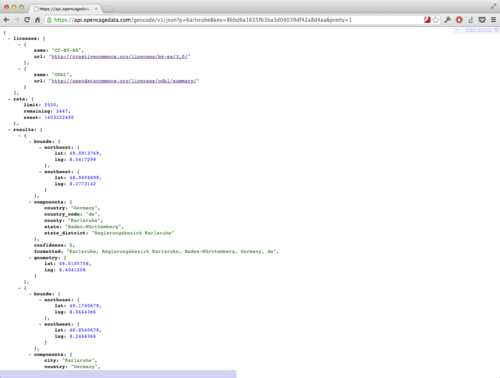
Check. The OpenCage geocoding API is simple RESTful API that will give you a response in the form of a map or a data payload in JSON or XML formats.
We believe you should be able to see what a geocoding API does from your browser and from the command line.
Check. Because our API is RESTful you can plug geocoding requests straight into your web browser of choice or if you prefer the command line, you can use tools such as curl or wget too.
We believe that you should be able to easily access a geocoding API from your language of choice, be that PHP, Perl, Python, Ruby or any other language.
Check. We’ve written API wrappers for you in PHP, Python, Perl and Ruby. Someone’s already working on a .NET implementation as well. Plus if you’re using Leaflet’s Javascript maps API, then there’s also a Leaflet plugin that lets you do geo-search using the OpenCage geocoder.
If you’d like to know more about the API head over to geocoder.opencagedata.com for the full details. There’s also a video of Gary, our geotechnologist-in-residence, announcing the geocoder at SOTM-EU, as well as a write up of the announcement on his personal blog.
So sign up now, take the API for a test drive and most important of all, let us know what you think. We’re waiting to hear from you.