Today it’s our pleasure to chat with Emir Hartato about OpenStreetMap in Indonesia.
1. Who are you and what do you do? What got you into OpenStreetMap?
My name is Emir Hartato and I’m working with Humanitarian OpenStreetMap Team (HOT) for project in Indonesia. I just know about OSM in my third year of my undergraduate study (2011) in Geography Department University of Indonesia, and Kate Chapman (HOT Executive Director) with Kristy van Putten (Australia-Indonesia Facility for Disaster Reduction, AIFDR) came to my campus and introduced me to OSM. I got hooked into OSM then became an intern for Community Mapping Pilot in Indonesia, and started to spread the words about OSM through workshop across the country.
Since then, OSM really open my eyes that this is the right tools that we need it. I mean, there are 250 million people in Indonesia and most of area still don’t have a detailed map. Imagine if each person adding a features per day, there will be 250 million new features every day :) So I started to help writing and translating training materials which now available in LearnOSM.org.
2. What would you say is the current state of OSM and the OSM community in Indonesia?
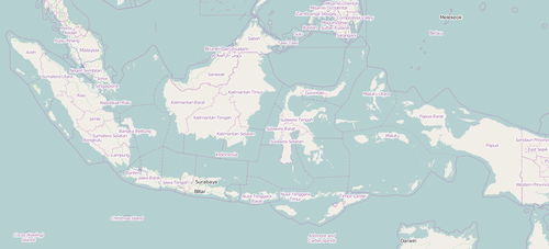
OSM in Indonesia is growing, people from different stakeholders (private, student, and government) are exposed with OSM and they are improving the map for different kind of purposes. HOT in Indonesia also did a lot of trainings, since the pilot until Oct 2014, there are 78 training in 14 different provinces, and 2,066 people had the training. We listed every training here. For the community itself, we are trying different approach by having discussion through social media like Facebook and Twitter instead by traditional mailing-list since people more familiar with social media.
The number of objects been mapped also enormous. You can watch the video here: OSM 2013 Indonesia Edits - Jakarta, Sumbawa, Padang
3. What are the unique challenges and pleasures of OpenStreetMap in Indonesia? What aspects of the projects in Indonesia should the rest of the world be aware of?
The pleasure of OSM in Indonesia is when you’re mapping, you will see through the imagery that Indonesia is a beautiful country and has a lot of different kind of unique features that people can explore and learn about it. Also when I trained people, I can travel to a lot of new places, meet different people. We have more than 300 different ethnics in Indonesia. But, these also can be challenging for us because people map things differently in terms feature tagging. People see things differently, and living in a country with more 300 different ethnics means there will be possibilities to have more than 300 different tagging for an object.
The rest of the world should aware that we can unlock a lot of potential with OSM. In Indonesia, OSM has been used for many purposes but mostly we are working with government in Disaster Risk Reduction (DRR) aspects. We are using OSM before disaster happen to create a contingency planning, during disaster for helping response team in the field and identifying evacuation center location, also post disaster to calculate damage and losses assessment. For contingency planning, we are feeding OSM building and road data to InaSAFE, a free and open source QGIS plugin to calculate disaster impact scenario.
4. What steps could the global OpenStreetMap community take to help support OSM in Indonesia?
I think so far global OSM community has been really supportive for OSM community growth in Indonesia. For example, Padang was the first task in OSM Tasking Manager (a tool to coordinate remote mappers), and we had a lot of people from around the world mapping Padang city because it is one of the most hazard prone area (earthquake and tsunami).
5. OSM recently celebrated it’s 10th birthday, where do you think the project will be in 10 years time, both globally and in Indonesia specifically?
There was someone asking me when Indonesia will be fully mapped? Well, that is the question I cannot answer. I mean, place is always dynamic, it will always changing thorough time. And not just in Indonesia, including the whole world also. So, the project will still going on all over the world. But maybe in 10 years, people will more focus for updating and data quality assessment since we already draw everything on the map (hopefully)!
Many thanks Emir, to you and everyone else mapping in Indonesia. Those wishing to keep a tab on their progress should follow the OSM Indonesia twitter account.
You can see all the Open Geo interviews here. If you are or know of someone we should interview, please get in touch, we’re always looking to promote people doing interesting things with open geo data.