<?xml version="1.0" encoding="utf-8"?><feed xmlns="http://www.w3.org/2005/Atom" ><generator uri="https://jekyllrb.com/" version="4.4.1">Jekyll</generator><link href="https://blog.opencagedata.com/feed/by_tag/osminterview.xml" rel="self" type="application/atom+xml" /><link href="https://blog.opencagedata.com/" rel="alternate" type="text/html" /><updated>2026-05-08T11:18:22+00:00</updated><id>https://blog.opencagedata.com/feed/by_tag/osminterview.xml</id><title type="html">OpenCage Blog</title><subtitle>Updates and musings from the makers of the &lt;a href=&quot;https://opencagedata.com&quot;&gt;OpenCage Geocoding API&lt;/a&gt;
</subtitle><entry><title type="html">Interview: Volker Krause on Transitous</title><link href="https://blog.opencagedata.com/post/openstreetmap-interview-transitous" rel="alternate" type="text/html" title="Interview: Volker Krause on Transitous" /><published>2026-05-08T08:06:10+00:00</published><updated>2026-05-08T08:06:10+00:00</updated><id>https://blog.opencagedata.com/post/transitous</id><content type="html" xml:base="https://blog.opencagedata.com/post/openstreetmap-interview-transitous"><![CDATA[<p>Today in our <a href="/tagged/osminterview">OpenStreetMap interview series</a> we speak with Volker Krause about <a href="https://en.osm.town/@transitous/">Transitous</a>, a community-driven, open platform for public transport routing. We explore the challenges of relying on proprietary transit APIs, the importance of open data for mobility, and how projects like Transitous are pushing the boundaries of what’s possible with OpenStreetMap and collaborative infrastructure.</p>

<p><a href="https://transitous.org/" class="center-image"><img src="/images/transitous.png" alt="Screenshot of the Transitous website" /></a></p>

<h3 id="1-can-you-introduce-yourself-your-involvement-with-openstreetmap-and-what-first-got-you-interested-in-open-mapping">1. Can you introduce yourself, your involvement with OpenStreetMap, and what first got you interested in open mapping?</h3>

<p><em>I’m <a href="https://en.osm.town/@VolkerKrause@floss.social">Volker</a>, contributing to Free Software for more than two decades, mostly in the KDE community. As part of the work on the travel app “Itinerary”, I started using OpenStreetMap data, initially for indoor map rendering and indoor routing, especially in train stations. That’s also how I ended up as part of the team that started Transitous two years ago.</em></p>

<h3 id="2--what-is-transitous-and-what-motivated-you-to-build-it-what-problem-are-you-trying-to-solve-with-it">2.  What is Transitous, and what motivated you to build it? What problem are you trying to solve with it?</h3>

<p><em>The primary source for public transport routing for Free Software applications prior to Transitous were the proprietary APIs of public transport operators and agencies. Usage of those was tolerated at best, the APIs had to be reverse engineered and could change or even disappear entirely at any time.</em></p>

<p><em>That’s not an ideal foundation to build applications on, so we wanted something better. Transitous is a public transport routing service built entirely on Free Software and Open Data. It’s run by the community as shared infrastructure for free applications needing access to realtime public transport data.</em></p>

<h3 id="3-why-does-it-matter-to-build-open-shared-public-transport-routing-infrastructure-instead-of-relying-on-proprietary-platforms">3. Why does it matter to build open, shared public transport routing infrastructure instead of relying on proprietary platforms?</h3>

<p><em>What’s even worse than the technical limitation mentioned above is that these proprietary APIs only cover the regions an operator is active in, and only their own services. While understandable from their perspective, as a traveler I don’t want to have to manually find the right operators for the regions I’m traveling in, and to query multiple sources to get the full picture of all available options.</em></p>

<p><em>Transitous doesn’t care about regional nor operator boundaries, on the contrary.</em></p>

<p><em>Having no conflicting interests also allows us to look into things that are unlikely to be provided in proprietary services. One such example is transfer routing for wheelchair users, taking into account the realtime operation status of elevators. These kinds of features usually only appear in proprietary services in response to regulatory pressure.</em></p>

<p><em>Another example is ongoing work for taking empirical delay information into account, something that is also very unlikely to be done by operators trying to advertise their own services.</em></p>

<p><em>We’ll only get things like these if we as a community build them ourselves, and Transitous is a platform on which we can do this.</em></p>

<p><img src="/images/transitousapps.png" alt="Apps using Transitous" class="center-image" /></p>

<h3 id="4-where-does-openstreetmap-data-work-well-for-routing-today-and-where-does-it-still-fall-short-especially-for-pedestrians-and-public-transport-use-cases">4. Where does OpenStreetMap data work well for routing today, and where does it still fall short, especially for pedestrians and public transport use cases?</h3>

<p><em>The OpenStreetMap data generally works very well for routing, and the fact we just have to work with one single integrated planet-wide dataset alone is a massive help.</em></p>

<p><em>For routing transfers inside e.g. train stations there’s some aspects where improving the mapping would help though.</em></p>

<p><em>In multi-floor stations we heavily rely on the “level” tag. Its use and maintenance varies a lot across different countries. Also, none of the standard views on the OSM website visualize it in any way yet, which isn’t helping with this either.</em></p>

<p><em>When considering accessibility in routing it’s mostly about the level of detail. Technically it’s not a big difference whether you route for a pedestrian or a wheelchair user, but for the latter the result becomes useless if we miss just a single step somewhere. So every such barrier has to be mapped for this to work reliably.</em></p>

<h3 id="5-what-are-the-main-technical-and-data-integration-challenges-in-building-a-cross-border-public-transport-routing-system-using-openstreetmap-and-open-transit-data">5. What are the main technical and data integration challenges in building a cross-border public transport routing system using OpenStreetMap and open transit data?</h3>

<p><em>For the public transport schedule data we don’t have the luxury of a single integrated dataset. There we are currently integrating more than 3000 data feeds. Those need to be properly aligned so overlaps don’t result in duplicates, and normalized so that you get consistent results everywhere.</em></p>

<p><em>Part of that is also realtime data that updates once a minute, and that continuously needs to be matched to the static baseline data. Given the rapid update frequency, this has to work fully automatic, without human review or intervention.</em></p>

<h3 id="6-what-could-the-openstreetmap-and-open-mobility-communities-do-to-better-support-projects-like-transitous">6. What could the OpenStreetMap and open mobility communities do to better support projects like Transitous?</h3>

<p><em>While there’s of course always details in the data that could be improved, the collaboration with the OSM community works great.</em></p>

<p><em>Public transport operators actually providing their data (which at least in the EU is legally required), doing so with a decent quality, and being responsive to feedback to issues we find would help a lot though. How well that is done varies greatly unfortunately.</em></p>

<h3 id="7-openstreetmap-recently-celebrated-20-years-where-do-you-see-the-project-in-another-20-years">7. OpenStreetMap recently celebrated 20 years. Where do you see the project in another 20 years?</h3>

<p><em>I’m sure OSM will still be around and be more relevant than ever. I find it very hard to predict how things will evolve though.</em></p>

<p><em>For example: Just three years ago a community-run public transport routing service with even just national-wide coverage was considered technically impossible with realistically available resources. Two years ago the assumption was that the best we could do is stop-to-stop routing in a handful of European countries. Recently our test server has demonstrated door-to-door routing from Berlin to Tokyo. Something that might seem infeasible today might just get implemented tomorrow.</em></p>

<p><em>One area in the vicinity of OSM that I’d like to see progress in and that today is still dominated by a few proprietary vendors is dynamic traffic data, i.e. anything from temporary road closures to traffic flow data. I hope we’ll have all that liberated as well eventually, maybe even a bit earlier than in 20 years.</em></p>

<hr />

<p>Transitous demonstrates the power of open data and community collaboration in solving complex mobility challenges, from cross-border routing to accessibility-aware navigation. As Volker notes, the future of open mobility will depend on how communities continue to build and expand these shared systems.</p>

<p>A big thank you to Volker Krause for sharing his insights.</p>

<p><a href="https://mastodon.social/@SuperDani">Danielle</a></p>

<p>Please let us know if your community would like to be part of
<a href="https://blog.opencagedata.com/tagged/osminterview">our interview series</a>
here on our blog. If you are or know of someone we should interview, please get in touch, we’re <a href="/post/98139732993/call-for-open-geo-openstreetmap-interviewees">always looking to promote people doing interesting things with open geo data</a>.</p>]]></content><author><name></name></author><category term="interview" /><category term="openstreetmap" /><category term="osminterview" /><category term="transitous" /><summary type="html"><![CDATA[Interview with Volker Krause about Transitous, a community driven, open platform for public transport routing.]]></summary></entry><entry><title type="html">Interview: Christian Quest on Creating the Panoramax Foundation</title><link href="https://blog.opencagedata.com/post/openstreetmap-interview-panoramax" rel="alternate" type="text/html" title="Interview: Christian Quest on Creating the Panoramax Foundation" /><published>2026-04-24T08:06:10+00:00</published><updated>2026-04-24T08:06:10+00:00</updated><id>https://blog.opencagedata.com/post/panoramax</id><content type="html" xml:base="https://blog.opencagedata.com/post/openstreetmap-interview-panoramax"><![CDATA[<p>It’s a pleasure to welcome Christian Quest of the <a href="https://www.ign.fr/institut/identity-card">French Geographic Institute</a> back to our <a href="/tagged/osminterview">OpenStreetMap interview series</a>. Our last conversation with him dates all the way back to 2015. Since then, both OpenStreetMap and his work with Panoramax have evolved significantly, and we’re glad to revisit his insights at this important moment.</p>

<h3 id="1-who-are-you-and-what-do-you-do-what-got-you-into-openstreetmap">1. Who are you and what do you do? What got you into OpenStreetMap?</h3>

<p><em>I’m Christian Quest, almost 60, currently working at IGN (French Geographic Institute) on <a href="https://panoramax.fr/#focus=pic&amp;map=17/48.857143/2.29424&amp;pic=40036f4e-d266-48e1-948d-0f0fa3ce681e&amp;speed=250&amp;xyz=56.00/0.00/30">Panoramax</a>.</em></p>

<p><em>My first contact with OpenStreetMap was in 2009, when I signed in. Then I became a founding member of OpenStreetMap France, in 2011 and a board member for 11 years. I’m still maintaining a large part of OSM-FR servers, including the OSM-FR Panoramax server and blurring API.</em></p>

<h3 id="2-what-is-the-proposed-panoramax-foundation-what-inspired-you-to-create-it">2. What is the proposed Panoramax foundation? What inspired you to create it?</h3>

<p><em>Panoramax is a project that started in 2022. OpenStreetMap France proposed to IGN to work together to build an open source, collaborative, decentralized and federated way of sharing ground level imagery. The idea was not new, I proposed something similar back in 2012!</em></p>

<p><em>After almost 4 years, it is time to setup a dedicated structure to take care of the project which cannot stay inside the French borders. We already have Panoramax servers in Taiwan, Wales, Spain, Croatia and several others should arise soon.</em></p>

<p><em>The OSM foundation is a source of inspiration, mainly on its light approach. OSMF takes care of the very core things (the main database, some basic services on top of it, and tools for the contributors), letting an ecosystem and local chapters build on that core to provide many additional services around OSM data.</em></p>

<p><em>I think the Panoramax foundation should also take care of the core of the project, like the meta-catalog that is federating the autonomous local Panoramax instances and some shared tools for contributors or to help set up new Panoramax instances.</em></p>

<p><em>Another thing the Panoramax foundation should take care is the coordination of the actual software stack development. This does not mean the foundation will do all developments, but it should make sure they fit a shared goal for the emerging Panoramax ecosystem.</em></p>

<p><img src="/images/Panoramax.png" alt="Screenshot of the Panoramax webpage" class="center-image" /></p>

<h3 id="3-what-unique-challenges-or-obstacles-do-you-foresee-in-creating-the-panoramax-foundation">3. What unique challenges or obstacles do you foresee in creating the Panoramax foundation?</h3>

<p><em>The diversity of actors can be a source of challenge because we already have public services, local authorities, companies, not-for-profit structures and individuals involved in the project and their culture may be quite different.</em></p>

<p><em>Another source of challenge is the international aspect. We’ve been moving quite fast in France, but Panoramax is still not massively deployed outside of France.</em></p>

<h3 id="4-the-creation-of-the-foundation-is-expected-at-the-end-of-august-during-the-annual-openstreetmap-conference--how-can-the-osm-community-get-involved-and-what-types-of-contributions-would-be-most-helpful">4. The creation of the foundation is expected at the end of August during the annual OpenStreetMap conference.  How can the OSM community get involved, and what types of contributions would be most helpful?</h3>

<p><em>The SotM 2026 in Paris is an opportunity that we could not miss to extend Panoramax. We’ve been talking many times during the past years about creating a Panoramax foundation, setting the SotM 2026 as the birth of this foundation is pushing all the possible founding members to move forward before that date.</em></p>

<p><em>Some hardware, hosting and human resources will be needed. These can be donated to the foundation (hardware, hosting or human work time), and some may need to be funded. Funding can come from foundation membership fees, grants, donations, and other sources allowed by the law for non profit associations.</em></p>

<h3 id="5-openstreetmap-recently-celebrated-its-20th-anniversary-as-someone-who-has-been-active-in-osm-for-years-where-do-you-see-the-project-in-20-years">5. OpenStreetMap recently celebrated its 20th anniversary. As someone who has been active in OSM for years, where do you see the project in 20 years?</h3>

<p><em>That’s a very difficult question to answer!</em></p>

<p><em>I see many challenges that we need to address… “data gardening” is my main concern. OSM needs more and more contributors to maintain the ever increasing amount of data.</em></p>

<p><em>Maybe more automation will be used to help gardening, but I’m also afraid of the AI trend if it is not viewed with enough objectivity.</em></p>

<p><em>We should continue to see OSM first as a community, then as a huge amount of data maintained by this community.</em></p>

<p>Thank you, Christian, for taking the time to speak with us again and share your perspective. It’s been great catching up after all these years, and we look forward to seeing how your work with Panoramax and OpenStreetMap continues to develop.</p>

<p><a href="https://mastodon.social/@superdani">Danielle</a> and the OpenCage team</p>

<p>Please let us know if your community would like to be part of
<a href="https://blog.opencagedata.com/tagged/osminterview">our interview series</a>
here on our blog. If you are or know of someone we should interview, please get in touch, we’re <a href="/post/98139732993/call-for-open-geo-openstreetmap-interviewees">always looking to promote people doing interesting things with open geo data</a>.</p>]]></content><author><name></name></author><category term="interview" /><category term="openstreetmap" /><category term="osminterview" /><category term="panoramax" /><category term="christianquest" /><summary type="html"><![CDATA[Interview with Christian Quest about the creation of the Panoramax foundation]]></summary></entry><entry><title type="html">Interview: Freemap Slovakia</title><link href="https://blog.opencagedata.com/post/openstreetmap-interview-freemapslovakia" rel="alternate" type="text/html" title="Interview: Freemap Slovakia" /><published>2026-03-13T08:06:10+00:00</published><updated>2026-03-13T08:06:10+00:00</updated><id>https://blog.opencagedata.com/post/freemap-slovakia</id><content type="html" xml:base="https://blog.opencagedata.com/post/openstreetmap-interview-freemapslovakia"><![CDATA[<p>In this edition of our <a href="/tagged/osminterview">OpenStreetMap interview series</a> we speak with Martin Ždila of <a href="https://www.freemap.sk/#map=9/52.474600/13.416400&amp;layers=X/">Freemap Slovakia</a>, the Slovak local chapter of the OpenStreetMap Foundation. Founded in 2009 and run entirely by volunteers, the organisation promotes OpenStreetMap in Slovakia, develops the freemap.sk map portal, and helps improve national map data. In this interview, Martin shares insights into the Slovak mapping community, its achievements, and the challenges it faces.</p>

<h3 id="1-who-are-you-and-what-do-you-do-what-got-you-into-openstreetmap">1. Who are you and what do you do? What got you into OpenStreetMap?</h3>

<p><em>Martin: We are Freemap Slovakia, the Slovak local chapter of the OpenStreetMap Foundation, established in 2009. Our main goals are to promote OpenStreetMap in Slovakia, to build and operate our own map portal <a href="https://www.freemap.sk">freemap.sk</a>, and to improve OSM data coverage — including negotiating access permissions and performing imports from open government sources. The organisation is run entirely by volunteers.</em></p>

<h3 id="2-what-would-you-say-is-the-current-state-of-osm-and-the-osm-community-in-slovakia">2. What would you say is the current state of OSM and the OSM community in Slovakia?</h3>

<p><em>Martin: Slovakia has a small but technically skilled and dedicated community. On a typical day, around 10–20 mappers are active, and the top contributors are very prolific. Many active Slovak mappers are not yet members of Freemap Slovakia — if you map in Slovakia, we’d love you to join us! We’d also like to attract more mappers overall, especially from rural areas and smaller towns that are still less well covered.</em></p>

<p><em>Data coverage is strong for a country our size. Address coverage stands at around 96%, road networks and hiking trails are well-maintained, and we have excellent open government geodata to work with: the Ortofotomozaika SR provides high-resolution aerial imagery updated in regular cycles, and high-quality LiDAR data is publicly available — we actively use both for improving landcover, waterways, and terrain shading.</em></p>

<p><em>We also have a close relationship with the Czech OSM community — cross-posting in each other’s forums is common, and we jointly organise the annual State of the Map CZ+SK conference.</em></p>

<p><a href="https://www.freemap.sk/" class="center-image"><img src="/images/freemap-slovakia.png" alt="Screenshot of Freemap Slovakia's webpage" /></a></p>

<h3 id="3-what-are-the-unique-challenges-and-pleasures-of-openstreetmap-in-slovakia-what-things-should-the-rest-of-the-world-be-aware-of">3. What are the unique challenges and pleasures of OpenStreetMap in Slovakia? What things should the rest of the world be aware of?</h3>

<p><em>Martin: The landscape is a genuine pleasure to map — Carpathian mountain ranges, dense forests, thousands of kilometres of marked hiking and cycling trails, castles and historical sites. There is always something interesting to add or refine.</em></p>

<p><em>We are proud of www.freemap.sk — our non-commercial map portal built on OSM data, offering a detailed outdoor map for hiking, cycling, skiing, and horse riding across Central Europe. It includes marked trail overlays, route planning for many transport modes, a GPX track viewer, live tracking (OsmAnd, Locus, Traccar), offline map export, GPS device map downloads, and a community photo layer — available in seven languages. We also maintain LiDAR-based tooling for landcover tracing and waterway accuracy improvement.</em></p>

<p><em>On the challenge side, the open government data situation has been deteriorating. Our government has been gradually closing datasets that were previously freely available, and the cadastral office suffered a serious cyberattack with poor backups, slowing access to up-to-date cadastral data. This is a real concern for OSM in Slovakia going forward.</em></p>

<h3 id="4-what-is-the-best-way-to-get-involved-is-there-a-regular-meet-up-a-mailing-list-where-does-the-community-meet-in-person-and-online">4. What is the best way to get involved? Is there a regular meet-up? A mailing list? Where does the community meet (in person and online)?</h3>

<p><em>Martin: The best starting point is our <a href="https://groups.google.com/g/osm_sk">Google Group:</a>— technical discussions, import proposals, and mapping questions all happen there.</em></p>

<p><em>For news and updates we also have a <a href="https://www.facebook.com/FreemapSlovakia">Facebook page</a> and a <a href="https://en.osm.town/@FreemapSlovakia">Mastodon account </a>.</em></p>

<p><em>In person, we hold an annual general assembly once a year as a weekend gathering — talks, planning, and always some local mapping. A good chance for remote contributors to finally meet.</em></p>

<h3 id="5-what-steps-could-the-global-openstreetmap-community-take-to-help-support-osm-in-slovakia">5. What steps could the global OpenStreetMap community take to help support OSM in Slovakia?</h3>

<p><em>Martin: Anything that helps OSM globally helps Slovakia too — better tooling, broader public awareness, stronger core infrastructure.</em></p>

<p><em>One area worth highlighting specifically: the OSM tagging schema. Documentation for many tags is unclear or unfinished, and the same feature often has multiple competing tagging conventions. The community should be less afraid to clean up legacy tags and consolidate — AI tools could actually be a real asset here for auditing and rationalising tagging at scale.</em></p>

<h3 id="6-openstreetmap-recently-celebrated-its-20th-birthday--a-natural-time-to-reflect-on-how-far-the-project-has-come-but-also-to-look-forward-where-do-you-think-the-project-will-be-in-10-years-both-globally-and-in-slovakia-specifically">6. OpenStreetMap recently celebrated its 20th birthday — a natural time to reflect on how far the project has come, but also to look forward. Where do you think the project will be in 10 years, both globally and in Slovakia specifically?</h3>

<p><em>Martin: Globally? Hoping for OSM API 0.7 😄. More seriously, I expect OSM to become the default base layer for geospatial applications worldwide, with AI-assisted mapping accelerating coverage in under-mapped regions — though quality assurance and community governance will need to keep pace.</em></p>

<p><em>For Slovakia, I hope to see address coverage climb from ~96% toward complete, and a general improvement in precision across all feature types — landcover from LiDAR, more accurate waterways, better building footprints. The data is largely there; the next decade is about refining and deepening it.</em></p>

<hr />

<p>Many thanks to Martin and the Freemap Slovakia team for taking the time to share their perspective and for the work they do supporting OpenStreetMap in Slovakia.</p>

<p>Forward!</p>

<p><a href="https://mastodon.social/@SuperDani">Danielle</a> and the OpenCage team</p>

<p>Please let us know if your community would like to be part of
<a href="https://blog.opencagedata.com/tagged/osminterview">our interview series</a>
here on our blog. If you are or know of someone we should interview, please get in touch, we’re <a href="/post/98139732993/call-for-open-geo-openstreetmap-interviewees">always looking to promote people doing interesting things with open geo data</a>.</p>]]></content><author><name></name></author><category term="interview" /><category term="openstreetmap" /><category term="osminterview" /><category term="freemapslovakia" /><summary type="html"><![CDATA[Interview with Martin Ždila of Freemap Slovakia]]></summary></entry><entry><title type="html">Interview: DW Innovation - SPOT</title><link href="https://blog.opencagedata.com/post/openstreetmap-interview-dwinnovation" rel="alternate" type="text/html" title="Interview: DW Innovation - SPOT" /><published>2026-02-27T08:06:10+00:00</published><updated>2026-02-27T08:06:10+00:00</updated><id>https://blog.opencagedata.com/post/dwinnovation-spot</id><content type="html" xml:base="https://blog.opencagedata.com/post/openstreetmap-interview-dwinnovation"><![CDATA[<p>In this next edition of our <a href="/tagged/osminterview">OpenStreetMap interview series</a> we speak with <a href="https://innovation.dw.com/en/articles/">DW Innovation</a> about <a href="https://www.findthatspot.io/">SPOT</a>, their tool for searching geospatial patterns in OpenStreetMap. They share how the project began, the challenges behind building it, and what they have learned since its launch.</p>

<h3 id="1-who-are-you-and-what-do-you-do-what-got-you-into-openstreetmap">1. Who are you and what do you do? What got you into OpenStreetMap?</h3>

<p><em>We are DW Research &amp; Cooperation projects. We research and experiment with new technologies in national and international innovation projects to get a clear picture of how journalism can benefit from those technologies.</em></p>

<p><em>In our research domain ‘verification’ we acknowledged that a very time-consuming process is the location verification of digital media. OpenStreetMap is a very interesting source of geolocation data as it contains non-commercial data that is relevant for geolocating digital media.</em></p>

<h3 id="2-what-is-spot-what-prompted-you-to-create-it-why-do-we-need-a-tool-like-this">2. What is SPOT? What prompted you to create it? Why do we need a tool like this?</h3>

<p><em>Imagine that you have to verify the location of a picture on which you can see a fountain and a church and a tower block within 60 metres of each other in the City of London. Google Maps won’t be able to help you searching for multiple entities at once, but in OSM you can actually search for geospatial information patterns.</em></p>

<p><em>The tool that we previously used for that is Overpass Turbo, however, it was rather complex to use for a lot of journalists. We decided to make searching in OSM easier and build a tool that can translate natural language prompts to search queries for geospatial patterns. The user won’t need to understand OSM tags and descriptors and can just prompt the system in their natural language, for example: ‘find a fountain and a church and a tower block within 60 metres of each other in the City of London’. The result will look like this:</em></p>

<p><a href="https://www.findthatspot.io/" class="center-image"><img src="/images/spot_prompt_london.png" alt="Screenshot of the SPOT London webpage" /></a></p>

<h3 id="3-what-are-the-unique-challenges-involved-in-creating-spot">3. What are the unique challenges involved in creating SPOT?</h3>

<p><em>As we started in a world that was just being introduced to LLMs and training them for specific purposes it was quite complex to find the right open source model that would provide us with robust translation of natural language prompts to OSM search queries. We have developed a fine-grained automated benchmarking system that allows us to compare LLM models and measure the impact of fine-tuning.</em></p>

<p><em>Another challenge is the tagging system of OSM. We have developed our own descriptor-tag bundle index to try and make sure that we cover any way of searching for e.g. a public bin. We have also clustered visually similar entities, for example all kinds of train rails, due to our geolocation verification use case.</em></p>

<h3 id="4-spot-was-launched-at-the-end-of-2024-launch-announcement---what-has-the-response-been-and-what-have-you-learned-since-then">4. SPOT was launched at the end of 2024 <a href="https://innovation.dw.com/articles/spot-the-easy-way-to-verify-locations/">launch announcement</a> - what has the response been and what have you learned since then?</h3>

<p><em>SPOT was received very well. The response from the journalistic and OSINT communities is very positive. We started with a Beta version that was not yet very stable. The early users saw the potential, looked through some bugs and provided us with very valuable feedback that allowed us to improve the application. Some, at first sight, minor issues led to insight that created structural changes in the system. Today, we have a well working, stable version that we can build on.</em></p>

<p><em>We are still learning that it is not easy to run well engaged open source projects. Building something, making it available for free and asking for input from like-minded is not necessarily the recipe for success. Also free products need to be marketed, also open source projects need to be well-managed and need Product Managers and Product Owners to thrive. We would be very happy to get more engagement from the OSM community, so if you can share the secret for that with us, we’d be much obliged!</em></p>

<h3 id="5-recently-openstreetmap-celebrated-20-years-where-do-you-think-the-project-will-be-in-another-20-years">5. Recently OpenStreetMap celebrated 20 years. Where do you think the project will be in another 20 years?</h3>

<p><em>Phew, I was never so good at looking into the future. I guess we’ll see the urge and necessity to work on digital sovereignty in the near future. Implementation of that will take a bit. OSM can serve as a great example of how a society can build and own data and applications. OSM could possibly also use this momentum to make a leap and lead the way as a platform independent from state or big tech.</em></p>

<p><em>And of course, we would love OSM to be easily searchable for geospatial information patterns by everyone ;)</em></p>

<hr />

<p>A big thank you to the team at DW Innovation for sharing their insights on SPOT and their work at the intersection of journalism, verification, and open geodata. We’re excited to see how SPOT and the wider OSM community continue to grow and collaborate in the years ahead.</p>

<p>Forward!</p>

<p><a href="https://mastodon.social/@freyfogle">Ed</a> and the OpenCage team</p>

<p>Please let us know if your community would like to be part of
<a href="https://blog.opencagedata.com/tagged/osminterview">our interview series</a>
here on our blog. If you are or know of someone we should interview, please get in touch, we’re <a href="/post/98139732993/call-for-open-geo-openstreetmap-interviewees">always looking to promote people doing interesting things with open geo data</a>.</p>]]></content><author><name></name></author><category term="interview" /><category term="openstreetmap" /><category term="osminterview" /><category term="dwinnovation" /><category term="spot" /><summary type="html"><![CDATA[Interview with DW Innovation about SPOT]]></summary></entry><entry><title type="html">Interview: Nicolas Collignon - Kale AI</title><link href="https://blog.opencagedata.com/post/openstreetmap-interview-kaleai" rel="alternate" type="text/html" title="Interview: Nicolas Collignon - Kale AI" /><published>2026-02-18T08:06:10+00:00</published><updated>2026-02-18T08:06:10+00:00</updated><id>https://blog.opencagedata.com/post/kaleai</id><content type="html" xml:base="https://blog.opencagedata.com/post/openstreetmap-interview-kaleai"><![CDATA[<p>In the second 2026 edition of our <a href="/tagged/osminterview">OpenStreetMap interview series</a> it was my pleasure to chat with <a href="https://www.linkedin.com/in/nccollignon/">Nicolas Collignon</a>, co-founder and CEO of <a href="https://kale.ai">Kale AI</a>, who are building urban routing solutions for delivery using OpenStreetMap.</p>

<p><a href="https://kale.ai/" class="center-image"><img src="/images/kaleai.png" alt="Screenshot of the Kale AI" /></a></p>

<h3 id="1-who-are-you-and-what-do-you-do-what-got-you-into-openstreetmap">1. Who are you and what do you do? What got you into OpenStreetMap?</h3>

<p><em>I’m Nico, my background is in computational cognitive science. I’m now the CEO of Kale AI, a start up building technology for urban logistics planning. I initially got into OpenStreetMap during a side quest where I got really curious about how to better understand urban tissue, and how to represent it computationally.</em></p>

<h3 id="2--what-is-kale-ai-what-prompted-you-to-create-it">2.  What is Kale AI? What prompted you to create it?</h3>

<p><em>Kale AI is a company focused on solving the inefficiency problem in urban logistics. We build tools to make complex logistics planning easy. It’s a very hard and interesting problem, and planning is one of the biggest weaknesses of LLMs. We’ve been focused on supporting the transition to Light EVs and cargo-bikes in modern urban logistics fleets. Light EVs are up to 2x more efficient in dense urban areas and use 95% less energy than diesel vans. They’re a multi-solution to improve urban life.</em></p>

<h3 id="3-why-do-we-need-special-routing-for-urban-logistics">3. Why do we need special routing for urban logistics?</h3>

<p><em>Different vehicles need tailored routing because urban space is becoming increasingly complex. With improving cycling infrastructure, Low Traffic Neighbourhoods and so on, all of this can lead to improved efficiency if we better route vehicles through street networks. For example, a 2-wheeled cargo bike might be able to take a shortcut that a 3-wheeler is blocked from by a bollard. For the 2-wheeler that can save 5-10 minutes off their route, but having to backtrack could add this in additional time for the slightly larger vehicle.</em></p>

<p><em>Most of our work doesn’t focus specifically on “navigation” but on planning, assigning deliveries to vehicles and designing the sequence of stops on those routes. Dantzig, who first proposed the Vehicle Routing Problem, explains quite well why it’s hard in his 1958 paper: “Even for small values of n the total number of routes is exceedingly large, e.g. for n = 15, there are 653,837,184,000 different routes.”</em></p>

<p><em>In our research, we found that deliverers spend 60-80% of their day not driving, but looking for parking and walking to the door. Different vehicles have different performance advantages in different parts of a city. Light EVs have a big advantage in the centre. Our work focuses on leveraging the different strengths of each vehicle type, and taking into account that diversity makes the VRP even harder to solve.</em></p>

<h3 id="4-what-are-the-unique-challenges-involved-in-routing-with-openstreetmap-particularly-for-urban-logistics">4. What are the unique challenges involved in routing with OpenStreetMap, particularly for urban logistics?</h3>

<p><em>The data quality is surprisingly good in well-mapped areas. The OSM community is incredibly detail-oriented. But two challenges stand out for us.</em></p>

<p><em>The first is completeness and heterogeneity. Coverage varies enormously, not just between cities but within them, and sometimes between streets that are literally 300 metres apart. In our research we found a striking example in Boston where two neighbouring hexagonal cells with almost identical satellite imagery had wildly different tagging. One had 167 highway:service tags, the other just 3. In Chicago suburbs we found a municipality with the highest population density in Illinois where OSM had recorded only 8% of its buildings. That kind of patchiness is a real problem when you’re trying to build models that generalise across cities.</em></p>

<p><em>The second is semantic consistency. OSM relies on contributors to categorise things freely, which means the same real-world object can be tagged in multiple ways depending on who mapped it and where. We saw this clearly across our study cities. Contributors in Los Angeles tagged single-family homes as building=house, while the same homes in other cities were tagged with the catch-all building=yes. Locally that’s fine, but the moment you try to build a model that works across cities, those inconsistencies become noise you have to work around.</em></p>

<p><em>And beyond the map itself, OSM captures the physical world but not the operational reality of deliveries. How long it takes to park, unload, walk to a door varies enormously by urban context and is invisible to any map. In our research, service time turned out to be one of the biggest drivers of delivery efficiency, yet almost no publicly available data exists on it. That’s a gap OSM can’t fill alone, but it points to how much logistics-specific ground truth is still missing.</em></p>

<h3 id="5-what-steps-could-the-openstreetmap-community-take-to-improve-mapping-for-urban-logistics">5. What steps could the OpenStreetMap community take to improve mapping for urban logistics?</h3>

<p><em>Keep tagging surfaces, seriously. It might feel niche, but it’s one of the most operationally significant pieces of data we use. The granularity OSM brings to surface data is something you simply can’t get from commercial providers, and it makes a real difference in planning accuracy.</em></p>

<p><em>Beyond that, access restrictions need more attention: bollards, width restrictions, turning restrictions, loading zone locations. These are the invisible barriers that can completely change how a fleet operates in a city, and they’re often missing or under-tagged. A restriction that a small vehicle sails through might stop a larger one entirely, and right now OSM rarely has enough detail to distinguish those cases.</em></p>

<p><em>More broadly, mapping Low Traffic Neighbourhoods and filtered permeability in a consistent, machine-readable way would be hugely valuable. These are increasingly shaping how urban freight actually moves, and having reliable structured data on them would let us plan far more accurately.</em></p>

<h3 id="6-recently-openstreetmap-celebrated-20-years-where-do-you-think-the-project-will-be-in-another-20-years">6. Recently OpenStreetMap celebrated 20 years. Where do you think the project will be in another 20 years?</h3>

<p><em>I think OSM is going to become even more foundational than it already is, but probably in ways that are less visible. A lot of the most interesting work being done today in autonomous mobility, urban planning, and logistics quietly depends on OSM as a base layer. That’s only going to grow.</em></p>

<p><em>What excites me is the intersection with AI. Models are getting better at extracting structured data from imagery, which could dramatically accelerate how quickly OSM reflects the real world: new infrastructure, surface changes, new access restrictions. The community’s role might shift from purely manual contribution toward curation and validation at scale.</em></p>

<p><em>And as cities get more complex, with more vehicle types, more restricted zones, more differentiated infrastructure, the value of a community that actually cares about tagging a bollard correctly becomes hard to overstate. That local, granular knowledge is something no corporate mapping effort has ever quite replicated.</em></p>

<hr />

<p>Thank you, Nico! Wonderful to see OpenStreetMap becoming a core part of the infrastructure of modern cities. As people, companies, communities use and rely on OSM, they will in turn start editing and maintaining the data for all of us to benefit.</p>

<p>Forward!</p>

<p><a href="https://mastodon.social/@freyfogle">Ed</a></p>

<p>Please let us know if your community would like to be part of
<a href="https://blog.opencagedata.com/tagged/osminterview">our interview series</a>
here on our blog. If you are or know of someone we should interview, please get in touch, we’re <a href="/post/98139732993/call-for-open-geo-openstreetmap-interviewees">always looking to promote people doing interesting things with open geo data</a>.</p>]]></content><author><name></name></author><category term="interview" /><category term="openstreetmap" /><category term="osminterview" /><category term="kalai" /><summary type="html"><![CDATA[Interview with Nicolas Collignon of Kale AI about how they are using OpenStreetMap to build the future of urban logistics delivery]]></summary></entry><entry><title type="html">Interview: CoMaps Team on Their Open-Source OSM Navigation App</title><link href="https://blog.opencagedata.com/post/openstreetmap-interview-comaps" rel="alternate" type="text/html" title="Interview: CoMaps Team on Their Open-Source OSM Navigation App" /><published>2026-01-09T08:06:10+00:00</published><updated>2026-01-09T08:06:10+00:00</updated><id>https://blog.opencagedata.com/post/comaps</id><content type="html" xml:base="https://blog.opencagedata.com/post/openstreetmap-interview-comaps"><![CDATA[<p>In the first 2026 edition of our <a href="/tagged/osminterview">OpenStreetMap interview series</a> we speak with some of the makers of <a href="https://www.comaps.app/">CoMaps</a>, a community-driven, free and open-source, offline navigation app that uses OpenStreetMap data.</p>

<p><a href="https://www.comaps.app" class="center-image"><img src="/images/comaps-hp.png" alt="Screenshot of the CoMaps website" /></a></p>

<h3 id="1-who-are-you-and-what-do-you-do-what-got-you-into-openstreetmap">1. Who are you and what do you do? What got you into OpenStreetMap?</h3>

<p><em>Will: I actually made my first edits, like many people, trying to make my area accurate for the Ingress and Pokemon Go. Later, I wanted an open source GPS app that didn’t track me, and found maps.me. I’m a web developer by trade, but learned C++ while trying to contribute to Organic Maps.</em></p>

<p><em><a href="https://www.openstreetmap.org/user/Bastian%20Greshake%20Tzovaras">Bastian</a>: By training, I’m a researcher coming from biology and bioinformatics, but I’ve spent the last 10 years or so working in different free &amp; open knowledge spaces. I got into OpenStreetMap when I was visiting Vietnam a couple of years ago and Google Maps refused to deliver instructions for bicyle navigation. That’s how I tried Organic Maps and did my first OSM edits. From there, I went down the mapping rabbit-hole.</em></p>

<p><em>Anton: I was working in a big industry complex where finding the buildings was super hard, when I discovered I could add them in OSM for me and the rest of my colleagues. Immediately, I got hooked on the idea of fixing things for yourself and the human collective. Then, I went and mapped a lot in my country of origin for which Google Maps wasn’t making an effort, and we were making OpenStreetMap have a better coverage in the region. Later, I discovered MapsMe until I didn’t like the changes and left the app until a couple of years later when I discovered Organic Maps, and it was my beginning in the open-source universe.</em></p>

<p><em><a href="https://www.openstreetmap.org/user/matheusgomesms">Matheus</a>: I am currently a Transportation Engineer. Like many people reading this interview, and as I said in a previous interview where <a href="https://blog.opencagedata.com/post/openstreetmap-brazil-update">OpenCage</a> supported my community, I needed an offline map (Maps.me), which later I discovered I could improve myself. I tried improving Google Maps, Waze and Apple Maps too, but it was (and still is) hard to succeed making my edits online. With OSM, this was never a problem.</em></p>

<p><img src="/images/comaps-img1.png" alt="img-info" class="center-image" /></p>

<h3 id="2-what-is-comaps-why-was-comaps-created-last-year-how-is-it-going">2. What is CoMaps? Why was CoMaps created last year? How is it going?</h3>

<p><em>CoMaps is a free &amp; open-source map/navigation app (mainly) for Android and iOS, that is based on OpenStreetMap data and focuses on a privacy-respecting, offline-map use. Users can download the map areas they need to their phone and then navigate those maps fully offline. In addition to OSM data, the app also includes offline Wikipedia-articles to points of interest that have those links saved in OSM.</em></p>

<p><em>CoMaps started in May 2025 as a fork of Organic Maps, which itself is a fork of maps.me, made by a group of volunteer contributors to Organic Maps. There are a couple of reasons for CoMaps forking from Organic Maps, centered around open source, transparency and shared decision making. These concerns were <a href="https://openletter.earth/open-letter-to-organic-maps-shareholders-a0bf770c">brought to the leadership of the company behind Organic Maps in an open letter</a>. Given the lack of response and meaningful changes, CoMaps was been started to create a more open and community-governed project.</em></p>

<p><em>Since then, CoMaps has been progressing quite rapidly for a “new” project: In 2025 we made 12 releases and started implementing our own improvements. This includes updated map styles, an improved routing engine, increasing details shown for electric vehicle chargers, and the ability to use your own map server, to be less dependent on CoMaps infrastructure.</em></p>

<p><em>Outside the technology bits, we have also grown our community quite a lot. Both in terms of code contributors but also all the folks that volunteer their time for making translations, writing blog &amp; social media posts, running language-specific community chats and many more.</em></p>

<h3 id="3-are-the-users-of-comaps-typically-already-familiar-with-openstreetmap">3. Are the users of CoMaps typically already familiar with OpenStreetMap?</h3>

<p><em>CoMaps is used by many different types of users, with different levels of familiarity with OpenStreetMap. Some of our most active users, and of course also contributors, are very familiar with OpenStreetMap and started using or contributing to CoMaps coming from the larger OSM world.</em></p>

<p><em>But there will be also many users who aren’t yet familiar with what OSM is and how to contribute to it. These are people who found CoMaps by way of a recommendation from their friends or family, or read about the project online when looking for map/navigation apps. As more and more people try to “degoogle” their lives, want to avoid “big tech” and lower their reliance on tools controlled by US corporations, the group of users who aren’t yet familiar with OSM but that just look for a replacement to commercial maps is likely to increase. Offline map apps are also really popular with backpackers and people with poor cell reception.</em></p>

<p><em>As time goes on, some users slowly “graduate” from being a pure consumer of OSM to becoming active contributors to OSM. This can start with using the basic OSM editor that’s part of CoMaps to make simple additions or leave notes, before moving to more dedicated and advanced editors. Bastian’s story of how he got into OpenStreetMap is a good example of that: His first contact to OSM was through using Organic Maps, which led him down the rabbit hole.</em></p>

<p><img src="/images/comaps-img2.png" alt="img-info" class="center-image" /></p>

<h3 id="4-to-what-extent-is-the-goal-of-the-service-just-to-provide-a-useful-tool-for-navigation-versus-trying-to-bring-users-into-the-openstreetmap-community-and-encouraging-them-to-contribute">4. To what extent is the goal of the service “just” to provide a useful tool for navigation versus trying to bring users into the OpenStreetMap community and encouraging them to contribute?</h3>

<p><em>We do see CoMaps as an important pathway for people to enter the OSM community with a low entry barrier, both through technical and social means.</em></p>

<p><em>On the technical level, we aim to keep the OSM editor inside CoMaps comparatively simple. It is focused on adding/editing simple Points of Interests and objects, without needing to know or understand the keys &amp; tags of OSM. For more complex or potentially destructive edits (like removing objects), we allow users to submit notes to OSM instead, to avoid that well-meaning newcomers accidentally delete information. The submitting of notes instead of edits works even for users who don’t have an OSM account yet, as they will be submitted as anonymous notes. By keeping things simple, we aim to get people interested in contributing, to help them onboard to become more regular OSM contributors down the line. We also think a lot about how to communicate and “onboard” the concept that edits will be sent out to the world, and the map is made accurate through their contributions.</em></p>

<p><em>To help with this onboarding, we have the community of CoMaps: Contributing and editing OSM are frequent topics on our <a href="https://www.comaps.app/community/">community channels</a>, whether that’s in the Matrix chat rooms or on Mastodon, Reddit etc. People share their questions and advice on how to improve the data in OSM, and through this learn to contribute also outside of CoMaps.</em></p>

<p><em>We also try to facilitate this by sharing tips and suggestions on how to contribute to OSM on our project website, e.g. <a href="https://www.comaps.app/news/2025-10-03/improving-routing-data-osm-errors/">how to spot common tagging mistakes like typos</a> that can help improve routing, or how to <a href="https://www.comaps.app/news/2025-10-17/improving-osm-notes/">help by responding to notes left by other CoMaps users</a>.</em></p>

<p><em>Through these different pathways of engaging with OSM through CoMaps and its community we try to grow the OSM community as well.</em></p>

<h3 id="5-the-sheer-comprehensiveness-of-osm-can-create-a-major-challenge-in-terms-of-visualizing-the-data-on-a-map-how-do-you-solve-this">5. the sheer comprehensiveness of OSM can create a major challenge in terms of visualizing the data on a map. How do you solve this?</h3>

<p><em>Ultimately, there is not a single way to “solve” this challenge, as different use cases require different maps and decisions for what to display on them and how. While this can be a challenge, it is also the big strength of OSM, as it enables creating maps tailored to those different use cases: Whether that’s <a href="https://brouter.de/">bike navigation via BRouter</a>, <a href="https://sosm.ch/the-coolest-way-to-find-shady-paths-vampire-routing-on-routing-osm-ch/">“vampire routing” to stay in the shade</a> or <a href="https://waterwaymap.org/">plotting waterways</a>.</em></p>

<p><em>For CoMaps we strive to create simple and readable maps that deliver a great experience for the most common “general purpose” map use cases, instead of diving deep into some or all of the potential specialist use cases. That means we prioritise creating maps that are very readable for general foot/bike/car navigation and exploration, displaying relevant POIs and objects, without cluttering the map with the full level of detail that OSM would theoretically afford.</em></p>

<p><em>The reasoning for this is that there is an inherent trade-off that generalist apps face. This is between simplicity or ease-of-use and how customizable/adaptable to specialist use cases your app can be. As you add more configuration or display options, your app becomes more and more able to support comparetively rare use-cases, but this comes at the cost at becoming much harder to understand due to this wealth of configuration options, which even affect the more common use cases.</em></p>

<p><em>Which isn’t to say that one approach is better than the other, as there are many specialist/niche use cases for maps for which other apps might be better suited than CoMaps is. Luckily, in the digital commons space around OSM &amp; open source, we do not need to compete or be “the best app for everything”, instead we are happy if we can provide an app that works for most people and their most common map needs, and encourage people to use other free &amp; open tools for the times where CoMaps isn’t ideal. We also happily work with those who do want a niche app, like BlueLight Maps which is a forked app for emergency vehicles and has contributed back to the project.</em></p>

<h3 id="6-what-is-the-best-way-for-people-to-get-involved-in-the-comaps-project">6. What is the best way for people to get involved in the CoMaps project?</h3>

<p><em>There are <a href="https://www.comaps.app/news/2025-12-16/comaps-and-its-community-end-of-2025/">many ways to get involved with CoMaps</a>, as there’s always a lot of things to do. It’s important to note that writing code for the apps, while very important, is only one aspect of contributing. We can always need help with many non-code tasks too: Whether that’s writing documentation/help pages; making translations to other languages; creating graphics for the app or website; responding to support requests or inquiries on social media; or any other task, help is always welcome.</em></p>

<p><em>For people who want to get to know us better, the easiest entry point is probably our main Matrix room (which is also bridged to Telegram). But really any of our online chat groups can be a good entry point: <a href="https://www.comaps.app/community/">www.comaps.app/community/</a></em></p>

<p><img src="/images/comaps-img3.png" alt="img-info" class="center-image" /></p>

<h3 id="7-last-year-openstreetmap-celebrated-20-years-where-do-you-think-the-project-will-be-in-another-20-years">7. Last year OpenStreetMap celebrated 20 years. Where do you think the project will be in another 20 years?</h3>

<p><em>It’s so hard to predict! Hopefully, much like the web and wikis, user-contributed data and apps will become even more common, and *“giving back”* will be more of an obvious choice. Google relies heavily on user submissions and edits with their maps, and many folks now have been raised on entertainment like Minecraft and Roblox where user-made content is not just key but even somewhat prestigious.</em></p>

<p><em>There’s also the aforementioned trend towards divesting from big tech, focusing more on privacy, and “degoogling” ones life. So the idea that you’re not being taken advantage of by a closed for-profit corporation is seeing some progress too! Which is all to say, hopefully both OSM and CoMaps will endure and even grow as public resources, unable to be walled off for private profit.</em></p>

<hr />

<p>Thank you, CoMaps team! It is so important to move OpenStreetMap from niche, hobbyist community to tool used broadly (and thus also supported and maintained) by society. Services like CoMaps are such an important entry point for getting people into the community.</p>

<p>Keep up the good work, and I look forward to following your progress.</p>

<p><a href="https://mastodon.social/@freyfogle">Ed</a></p>

<p>Please let us know if your community would like to be part of
<a href="https://blog.opencagedata.com/tagged/osminterview">our interview series</a>
here on our blog. If you are or know of someone we should interview, please get in touch, we’re <a href="/post/98139732993/call-for-open-geo-openstreetmap-interviewees">always looking to promote people doing interesting things with open geo data</a>.</p>]]></content><author><name></name></author><category term="interview" /><category term="openstreetmap" /><category term="osminterview" /><category term="comaps" /><summary type="html"><![CDATA[Interview with the CoMaps team about their community-driven, free, open-source, offline navigation app built on OpenStreetMap data for Android and iOS]]></summary></entry><entry><title type="html">Interview: Mikhail Kuzin: OSMPIE</title><link href="https://blog.opencagedata.com/post/openstreetmap-interview-osmpie-mikhail-kuzin" rel="alternate" type="text/html" title="Interview: Mikhail Kuzin: OSMPIE" /><published>2025-10-17T08:06:10+00:00</published><updated>2025-10-17T08:06:10+00:00</updated><id>https://blog.opencagedata.com/post/osmpie</id><content type="html" xml:base="https://blog.opencagedata.com/post/openstreetmap-interview-osmpie-mikhail-kuzin"><![CDATA[<p>In this month’s edition of our <a href="/tagged/osminterview">OpenStreetMap interview series</a> we speak with <a href="https://www.openstreetmap.org/user/Mikhail%20Kuzin">Mikhail Kuzin</a>, one of the makers of OpenStreetMap editor <a href="https://osmpie.org/">OSMPIE</a></p>

<p><a href="https://osmpie.org/" class="center-image"><img src="/images/osmpie-hp.png" alt="Screenshot of the OSMPIE site" /></a></p>

<h3 id="1-who-are-you-and-what-do-you-do-what-got-you-into-openstreetmap">1. Who are you and what do you do? What got you into OpenStreetMap?</h3>

<p><em>I’m Mikhail Kuzin, 41, married with two sons. I’ve spent over 20 years in software development, scientific research, and data science focused on road traffic. I hold a Master’s and Ph.D. in Computer Science (Mathematical Modeling). I lead a development team building Intelligent Transport Systems and co-founded a startup analyzing connected vehicle data.</em></p>

<p><em>Many scientific works rely on OSM data, and like other developers of road traffic modeling software and autonomous vehicles, we turned to it for road data. We had already developed several proprietary road network models for specific tasks, so naturally we started building a converter to import roads from OSM format into our systems.</em></p>

<p><em>Building accurate road networks is laborious, and we wondered: why recreate what already exists in many places? We quickly realized seamless, complete conversion wasn’t possible. Intersections are truly complex in their structure, and their representation varies significantly due to the human factor—everyone contributes data as they see it.</em></p>

<h3 id="2-what-is-osmpie-what-prompted-you-to-create-it-why-do-we-need-another-osm-editor">2. What is OSMPIE? What prompted you to create it? Why do we need another OSM editor?</h3>

<p><em>An editor is a tool that reflects a person’s needs in solving their tasks. If the tasks are specific, why not have a more convenient editor with fewer distracting objects? If you look at the entire multitude of OSM objects, obvious clusters are visible: buildings, roads, terrain (rivers, mountains, seas, forests, and individual trees), and POIs. Each of them has its own specifics for data entry.</em></p>

<p><img src="/images/osmpie-img2.png" alt="img-info" class="center-image" /></p>

<p><em>Especially with the development of the <a href="https://strassenraumkarte.osm-berlin.org/?map=micromap#18/52.47379/13.44164">idea of micro-mapping</a>. We have become accustomed to the capabilities of modern mapping systems (<a href="https://yandex.ru/maps/66/omsk/?ll=73.380364%2C54.972583&amp;z=18">Yandex</a>, <a href="https://2gis.ru/omsk/geo/282213711094197/73.382814%2C54.970556?floor=0&amp;m=73.383523%2C54.970326%2F18.52&amp;immersive=on">2GIS</a>, <a href="https://www.google.com/search?q=gaode%20navigation%20app%20roads%20screen&amp;hl=ru&amp;udm=2&amp;tbs=rimg:CR2ONwVl2iipYZAlZjQg4Hn2sgIAwAIA2AIA4AIA&amp;sa=X&amp;ved=0CB4QuIIBahcKEwjIqp2d3KqQAxUAAAAAHQAAAAAQBw&amp;biw=1775&amp;bih=925&amp;dpr=2#vhid=UxvCU0q04wI5_M&amp;vssid=mosaic">Gaode</a>). Mapping every tree or bench is “low-hanging fruit,” easy to pick. With roads, it’s not like that!</em></p>

<p><em>Road micro-mapping, i.e., the transition from the <a href="https://www.sciencedirect.com/science/article/pii/S1569843225004509?clckid=ef46d8dd">granularity level</a> of <code class="language-plaintext highlighter-rouge">way</code> to <code class="language-plaintext highlighter-rouge">lane</code>, causes a super-exponential explosion of connections (<code class="language-plaintext highlighter-rouge">relations</code>) between new objects or requires an immense number of actions.</em></p>

<p><em>A proposal for lane markup was recently approved, but even in small areas, maintaining such a number of objects is very labor-intensive. However, in reality, road markings are not random - most lines are drawn for a reason (although that happens too…), they have meaning (semantics) and a certain algorithm. OSMPIE is an attempt to recreate these algorithms.</em></p>

<p><em><a href="https://osmpie.org/">OSMPIE</a> changes some concepts:</em></p>

<ol>
  <li>
    <p><strong>Automation.</strong> <em>We thought: if our task is to seamlessly convert the OSM road network from the granularity level of <code class="language-plaintext highlighter-rouge">way</code> to <code class="language-plaintext highlighter-rouge">lane</code>, what are we missing? Why do we have to manually adjust points in the final model every time? How can we reduce this manual work, and ideally, get rid of it completely?</em></p>
  </li>
  <li>
    <p><strong>Data Philosophy.</strong> <em>Is OSM a map? A database? Let’s look at it differently. OSM is not just tags and points; it is an object-semantic model, a kind of programming language with its own structure and “code,” similar to HTML/CSS.</em></p>
  </li>
  <li>
    <p><strong>Intersection Semantics.</strong> <em>In OSM, the semantic area of intersections is not very well developed due to their complexity and diversity of relations. One of the main tasks was not just to add new tags, but to make their number <strong>minimal</strong> and, most importantly, to integrate them into the current ideology, for example, <code class="language-plaintext highlighter-rouge">*:lanes:*</code>. This took several years.</em></p>
  </li>
  <li>
    <p><strong>Collaboration.</strong> <em>A mapper is always a lone hero. I may not be a strong expert in OSM editors, but in Miro or Google Docs, I can collaborate, get feedback and comments - that’s real collaborative work. Why isn’t it like that in OSM? OSMPIE takes the first step towards this - you can share drafts or results of the intersection “baking” process. The cognitive complexity of intersections is very high, and as we say, two heads are better than one.</em></p>
  </li>
</ol>

<p><em>We have been using this editor for our own needs for several years and have created models of cities or their large parts for transport analytics. <a href="https://photos.google.com/album/AF1QipPJoOPiKseqQQ8L6ZG9jJXSN5HAqgKpWxDlqacJ">This is what it looked like before</a>.</em></p>

<p><img src="/images/osmpie-img1.png" alt="img-info" class="center-image" /></p>

<p><em>In 2025, we decided to offer it to the community, as we thought there wasn’t much work left - improve the editing process, change the authorization and the place for saving changesets to the common OSM database. Ha…</em></p>

<p><em>We would be happy if our ideas are discussed, improved, or accepted by the community. Then we could think about further development in this direction: expanding the API, plugins for other applications, and open source. If they are rejected… well, God bless OSM.</em></p>

<h3 id="3-what-are-the-unique-challenges-involved-in-mapping-intersections-in-openstreetmap">3. What are the unique challenges involved in mapping intersections in OpenStreetMap?</h3>

<p><strong>Lack of a Unified Model.</strong> <em>OSM lacks a coherent, unambiguous, and widely adopted standard for representing intersections.</em></p>

<p><strong>Geometric Accuracy vs. Simplification.</strong> <em>An intersection is not just a point where road lines cross. It is an area with its own boundaries where roads merge, split, have curves, traffic islands, and multiple lanes. How to accurately convey this form without making the map impossibly difficult to edit and use?.</em></p>

<p><strong>Semantic Model (Logical Structure).</strong> <em>Beyond visual representation, OSM must capture how intersections function: which turns are allowed, where crosswalks exist, how traffic lights control flow. Developing tags and rules that accurately describe this logic so navigation programs and mapping services can interpret it correctly remains the most challenging aspect.</em></p>

<p><strong>Topology (Road Network Connectivity).</strong> <em>It is crucial that roads at an intersection are correctly connected. One mistake - and the router will “think” that it’s impossible to pass here. Ensuring seamless connectivity of all entrances, exits, and lanes, especially on complex interchanges, is a difficult task. When we move to micro-mapping and the granularity level of <code class="language-plaintext highlighter-rouge">lane</code>, this problem becomes one of the main ones. The <code class="language-plaintext highlighter-rouge">connect:lanes</code> tag was proposed to the community for practical reasons. It does not replace <code class="language-plaintext highlighter-rouge">relation[type=connectivity]</code>, just as the tag <code class="language-plaintext highlighter-rouge">way[highway=* + cycleway:right=lane]</code> does not replace <code class="language-plaintext highlighter-rouge">highway=cycleway</code>. They coexist. <code class="language-plaintext highlighter-rouge">connect:lanes</code> allows conveniently setting connectivity as an attribute rather than creating a separate object. Example with cycleway <a href="https://osmpie.org/app/editor?pos=13.425174&amp;pos=52.486&amp;zoom=20.15&amp;bakeId=7edb9995-b958-4776-be55-5a7426c76916&amp;tile=Carto+Light">1</a> and <a href="https://osmpie.org/app/editor?bakeId=8d92e8c3-18d6-467a-a003-d3eaf9d3da4f&amp;pos=-73.967557&amp;pos=40.580387&amp;zoom=19.84&amp;tile=Carto+Light">2</a>.</em></p>

<p><em>When you try to map the roads of an entire city yourself, you will be able to make a choice.</em></p>

<p><strong>Dynamism and Level of Detail.</strong> <em>Intersections constantly evolve as new lanes emerge, traffic organization changes, and signs are installed. The challenge is maintaining such a complex model’s relevance while determining appropriate detail levels—do you map every arrow painted on asphalt?</em></p>

<h3 id="4-what-steps-could-the-openstreetmap-community-take-to-improve-mapping-of-intersections-specifically-and-roads-generally">4. What steps could the OpenStreetMap community take to improve mapping of intersections specifically and roads generally?</h3>

<p><em>I’d say the most impactful improvement is consistent use of <code class="language-plaintext highlighter-rouge">lanes:</code> and <code class="language-plaintext highlighter-rouge">turn:lanes</code> tags. This single step alone would bring significant improvements to intersection mapping. Beyond that, properly mapping <a href="https://wiki.openstreetmap.org/wiki/Proposal:Placement#Simple_transition_from_three_to_two_lanes"><code class="language-plaintext highlighter-rouge">placement</code></a>  at city intersections and interchanges is crucial. Pedestrian crossings should be drawn as separate <code class="language-plaintext highlighter-rouge">ways</code>—each zebra crossing as its own <code class="language-plaintext highlighter-rouge">way</code> rather than a single <code class="language-plaintext highlighter-rouge">way</code> encircling the entire intersection. These improvements don’t require specialized editors; they simply need community adoption of existing standards.</em></p>

<p><em>I have to appreciate the exceptional work many mappers are already doing in cities across the globe. When I open their roads in OSMPIE, they’re often perfect—nothing to correct, everything precisely in place. These mappers accomplish this remarkable level of detail “blindly,” without AI assistance or detailed renders, relying solely on their imagination and internal spatial vision. Their expertise and dedication deserve genuine recognition and respect from the community. Their approach demonstrates what’s possible when mappers commit to quality and precision. With OSMPIE, we were simply aiming to make their work easier.</em></p>

<h3 id="5-last-year-openstreetmap-celebrated-20-years-where-do-you-think-the-project-will-be-in-another-20-years">5. Last year OpenStreetMap celebrated 20 years. Where do you think the project will be in another 20 years?</h3>

<p><em>Twenty years is too long for accurate predictions. OSM is, fundamentally, about people. If dedicated contributors remain engaged, everything will be fine. I’m confident OSM will thrive. As an entry point for new ideas, it will continue attracting scientists and those who simply want to improve their local area.</em></p>

<p><em>Of course, much can change before then. In the near future, I expect “vibe mapping” to emerge—analogous to “vibe coding.” We’ll see specialized editors powered by AI, similar to Cursor. OSMPIE itself could provide training samples like “from-to” or “as-is-to-be.” When the OSM object model combined with OSMPIE results are vectorized collectively, this will unlock new possibilities for structural and semantic manipulation of OSM objects for AI—much as AI now works with words and meanings in text.</em></p>

<p><em>Micro-mapping and object recognition from photographs will undoubtedly advance. Why limit this to trees or benches as points? Imagine simply taking a photo on your phone and clicking “OK” to add objects. Perhaps this already exists — I’m just not current with recent developments.</em></p>

<hr />

<p>Thank you, Mikhail, for the detailed discussion of the complex problem that is intersection mapping. It is great to see the technology advancing, and I share your hope that this serves to take the discussion (and mapping forward).</p>

<p>Happy mapping (whether intersections or anything else),</p>

<p><a href="https://mastodon.social/@freyfogle">Ed</a></p>

<p>Please let us know if your community would like to be part of
<a href="https://blog.opencagedata.com/tagged/osminterview">our interview series</a>
here on our blog. If you are or know of someone we should interview, please get in touch, we’re <a href="/post/98139732993/call-for-open-geo-openstreetmap-interviewees">always looking to promote people doing interesting things with open geo data</a>.</p>]]></content><author><name></name></author><category term="interview" /><category term="openstreetmap" /><category term="osminterview" /><category term="OSMPIE" /><category term="Mikhail Kuzin" /><summary type="html"><![CDATA[We interview Mikhail Kuzin about OSMPIE, the OpenStreetMap Perfect Intersection Editor designed to make mapping road junctions easier]]></summary></entry><entry><title type="html">Supporting Mapeia Brasil / Interview</title><link href="https://blog.opencagedata.com/post/supporting-mapeia-brasil" rel="alternate" type="text/html" title="Supporting Mapeia Brasil / Interview" /><published>2025-10-01T08:06:10+00:00</published><updated>2025-10-01T08:06:10+00:00</updated><id>https://blog.opencagedata.com/post/mapeia-brasil</id><content type="html" xml:base="https://blog.opencagedata.com/post/supporting-mapeia-brasil"><![CDATA[<p>I am delighted to share news of our financial support of <a href="https://projeto-mapeiabrasil.mapaslivre.com.br/">Mapeia Brasil</a>, an initiative of UMBRAOSM (União dos Mapeadores Brasileiros do OpenStreetMap) to improve road data in OpenStreetMap (OSM) for strategic cities in Brazil.</p>

<p>We kick off the collaboration by interviewing <a href="https://www.openstreetmap.org/user/raphaelmirc">Raphael de Assis</a>, President of UMBRAOSM, as the next installment in our <a href="/tagged/osminterview">OpenStreetMap interview series</a>.</p>

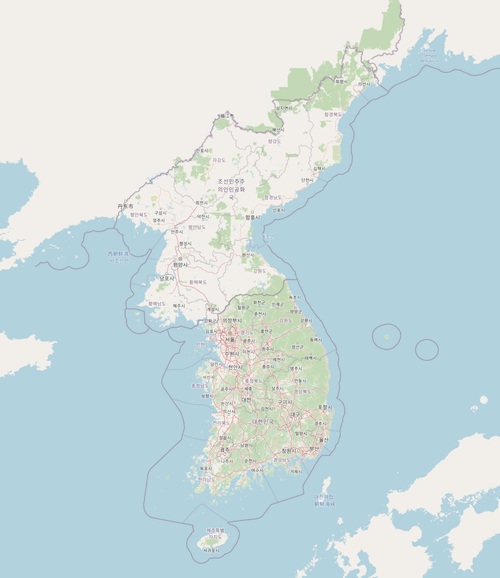
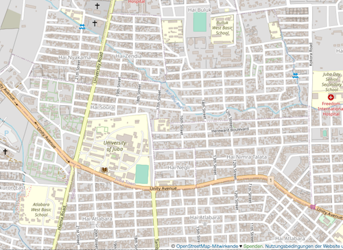
<p><a href="https://www.openstreetmap.org/#map=13/-9.97325/-67.82444" class="center-image"><img src="/images/osm-rio-branco.png" alt="A map of Rio Branco, Brazil - one of the cities that will be targeted by the Mapeia Brasil project" /></a></p>

<p><strong>1. Who are you and what do you do? What got you into OpenStreetMap?</strong></p>

<p><em>My name is Raphael de Assis, and I am an undergraduate student in Computer Networks at Faculdade Estácio de Sá. I am a member of the Communication Working Group of the OpenStreetMap Foundation and currently serve as president of <a href="https://www.umbraosm.com.br/">UMBRAOSM</a> – the Union of Brazilian OpenStreetMap Mappers. I work as a mentor in collaborative mapping projects, notably Mapeia Belém (2023–2024), which aimed to improve data for the city of Belém in preparation for COP30, and I am the creator of Mapeia Crato 2025. I also participated in coordinating the State of the Map (SOTM) Brazil 2023 in Curitiba</em></p>

<p><em>My interest in OpenStreetMap began in 2016 when I noticed the lack of available
data in the city of Recife/PE. This motivated me to become a volunteer for OSM and an advocate for open and free data in Brazil, aiming to make mapping more accessible, complete, and useful for everyone.</em></p>

<p><strong>2. What is the Mapeia Brasil project? Who is involved?</strong></p>

<p><em>Mapeia Brasil is a collaborative community mapping initiative aimed at improving the quality and coverage of geographic data in Brazilian cities.</em></p>

<p>_The main focus is the updating and correction of street names using official data from IBGE, especially from the 2022 Census. These efforts aim to make essential information more accessible for urban mobility, accessibility, planning, and
citizenship services.</p>

<p><em>The project seeks to engage volunteers and local communities, training people with no prior mapping or technology experience, and encouraging the creation of local mapper groups in various regions of the country.</em></p>

<p><em>Key participants include:</em></p>

<ul>
  <li>
    <p><em>Volunteers from the OpenStreetMap community across multiple Brazilian
cities.</em></p>
  </li>
  <li>
    <p><em>UMBRAOSM – Union of Brazilian OpenStreetMap Mappers, providing training and support to the participating mappers.</em></p>
  </li>
  <li>
    <p><em>Specific projects such as Mapeia Belém and Mapeia Crato, which serve as references for the methodology and impact of the project.</em></p>
  </li>
</ul>

<p><em>To learn more about the Mapeia Brasil project, follow the cities that will be updated during the initiative, and contact the organizers, visit <a href="https://projeto-mapeiabrasil.mapaslivre.com.br/">the official website</a>.</em></p>

<p><strong>3. What are the unique challenges and joys of mapping in Brazil?</strong></p>

<p><em>Brazil is a continental country with a wide diversity of urban and rural realities. This makes keeping maps up to date in all regions a significant challenge. Many municipalities still lack quality open data about streets, ZIP codes, neighborhoods, or public facilities, which makes mapping a more manual and collaborative task.</em></p>

<p><em>Additionally, Amazonian, quilombola, indigenous, and riverside regions have limited coverage, requiring adapted methodologies and cultural sensitivity. Urban contexts also pose challenges: many Brazilian cities have unnamed streets, irregular house numbering, recent settlements, and rapidly changing urban spaces.</em></p>

<p><em>On the other hand, mapping Brazil is also an enriching experience. It captures everything from complex metropolises to small villages, passing through unique biomes like the Amazon, Cerrado, Pantanal, and Caatinga. Mapping can support residents in advocating for improvements such as lighting, transportation, sanitation, and healthcare, functioning as a true tool of citizenship.</em></p>

<p><em>Brazil also has a very active OpenStreetMap community that develops local solutions, apps, and impactful projects. Examples include Mapeia Belém (2023), Mapeia Crato (2025), and the “mapatonas” promoted by UMBRAOSM in 2023 and 2024, which in 2025 will advance building mapping across multiple cities in Brazil. There is immense satisfaction in seeing the map grow through your own contributions, knowing that this collective effort benefits thousands of people nationwide.</em></p>

<p><em>Thus, the biggest challenge is dealing with the country’s size, information inequality, and limited infrastructure. The greatest joy is seeing mapping established as an instrument of social, cultural, and civic transformation.</em></p>

<p><strong>4. What would make this project a great success for you?</strong></p>

<p><em>The project would be a great success if the OpenStreetMap Foundation could provide micro-grants and volunteer training, allowing people from various regions of Brazil to participate actively. This would help communities create local mapper groups, strengthening regional engagement.</em></p>

<p><em>Additionally, global visibility for the project could attract other OSM partner organizations, expanding support for this initiative, which aims to improve data in 13 Brazilian cities. Consequently, these regions would have updated information, directly benefiting residents who could use it for urban mobility, accessibility, online shopping, and other daily activities.</em></p>

<p><strong>5. What is the best way for people to do something similar in their region?</strong></p>

<p><em>The best way to start is small and collaboratively. Each community can identify which information is most relevant to daily life—unnamed streets, public facilities, points of interest, or community services.</em></p>

<p><em>The first step is to use OpenStreetMap, an open and free platform, to map neighborhoods, villages, and cities. You can start with simple elements like streets, squares, schools, and health clinics.</em></p>

<p><em>It is also essential to organize the local community, creating volunteer groups and involving schools, universities, neighborhood associations, and collectives. To engage more people, hosting in-person or online mapathons is effective.</em></p>

<p><em>Training is also important: using guides, tutorials, and workshops, as well as offering continuous support for beginners through mentorship.</em></p>

<p><em>Forming partnerships with UMBRAOSM – the Union of Brazilian OpenStreetMap Mappers, an organization that trains new mappers and maps invisible areas, is crucial. This work gives visibility and dignity to people living in these regions, further strengthening the initiative.</em></p>

<p><em>Finally, it is essential to focus on social relevance. Choose themes with real impact, such as mobility, accessibility, environment, health, or infrastructure, and show that mapping is not just “drawing on a map” but a powerful tool for citizenship.</em></p>

<p><em>The secret is simple: unite people around a common cause, use open tools like OSM, and transform the map into a living reflection of the community’s needs and potential.</em></p>

<p><strong>6. What measures could the global OpenStreetMap community take to help support mapping projects like this and the Brazilian OSM community?</strong></p>

<p><em>The global OpenStreetMap community can play an important role in strengthening initiatives like Mapeia Brasil and directly supporting the Brazilian mapping community.</em></p>

<p><em>Some key measures include:</em></p>

<ul>
  <li>
    <p><em>Promoting knowledge exchange through training, webinars, and workshops led by global experts.</em></p>
  </li>
  <li>
    <p><em>Creating mentorship networks between experienced mappers and new volunteers in Brazil.</em></p>
  </li>
  <li>
    <p><em>Highlighting Brazilian initiatives internationally on OSM official channels and events such as State of the Map.</em></p>
  </li>
  <li>
    <p><em>Supporting social impact projects, such as mapping invisible areas led by UMBRAOSM, showcasing them as examples of community transformation.</em></p>
  </li>
  <li>
    <p><em>Providing micro-grants, community funds, or sponsorships for workshops, mapathons, and local initiatives.</em></p>
  </li>
  <li>
    <p><em>Recognizing and supporting UMBRAOSM for its crucial role in training new mappers and mapping invisible areas, giving visibility and dignity to historically neglected populations.</em></p>
  </li>
</ul>

<p><strong>7. Last year, OpenStreetMap celebrated 20 years. Where do you think the project will be in 20 years, both in Brazil and globally?</strong></p>

<p><em>Globally, in 20 years, OpenStreetMap will likely be a universal, real-time platform integrating street data, transportation, infrastructure, risk areas, and environmental changes.</em></p>

<p><em>In Brazil, the country will have detailed coverage of cities and rural areas, including peripheries and historically invisible regions on maps, thanks to collaborative initiatives like Mapeia Brasil and the work of UMBRAOSM.</em></p>

<p><em>Mapping will be a tool for citizenship, allowing communities to influence public
policies, advocate for improvements, and actively participate in urban planning.</em></p>

<p><em>The Brazilian OSM community will be an international reference, integrating humanitarian, academic, and technological projects, and demonstrating the social impact of collaborative mapping.</em></p>

<hr />

<p>Thank you, Raphael and everyone adding to OpenStreetMap in Brazil. We are proud to be able to play a small part in the project.</p>

<p>Happy mapping (whether in Brazil or elsewhere),</p>

<p><a href="https://mastodon.social/@freyfogle">Ed</a></p>

<p>Please let us know if your community would like to be part of
<a href="https://blog.opencagedata.com/tagged/osminterview">our interview series</a>
here on our blog. If you are or know of someone we should interview, please get in touch, we’re <a href="/post/98139732993/call-for-open-geo-openstreetmap-interviewees">always looking to promote people doing interesting things with open geo data</a>.</p>]]></content><author><name></name></author><category term="interview" /><category term="openstreetmap" /><category term="osminterview" /><category term="givingback" /><category term="brazil" /><category term="StreetNamesInBrazil" /><summary type="html"><![CDATA[We interview Raphael de Assis of UMBRAOSM about Mapeia Brasil, an initiative to improve OpenStreetMap road data in Brazilian cities]]></summary></entry><entry><title type="html">Interview: OpenStreetMap in Lyon, France</title><link href="https://blog.opencagedata.com/post/openstreetmap-interview-osm-lyon-thibaut-maito" rel="alternate" type="text/html" title="Interview: OpenStreetMap in Lyon, France" /><published>2025-09-27T08:06:10+00:00</published><updated>2025-09-27T08:06:10+00:00</updated><id>https://blog.opencagedata.com/post/osm-lyon</id><content type="html" xml:base="https://blog.opencagedata.com/post/openstreetmap-interview-osm-lyon-thibaut-maito"><![CDATA[<p>Our <a href="/tagged/osminterview">OpenStreetMap interview series</a> continues, this time we again learn about a regional OpenStreetMap community.</p>

<p>It was my pleasure to speak with Thibaut Maïto, an active member of the community in Lyon, France, a group that s very active <a href="https://mapstodon.space/@osm_lyon">on mastodon as @osm_lyon</a>, which is how we came into contact.</p>

<p><a href="https://www.openstreetmap.org/#map=13/45.75177/4.83836" class="center-image"><img src="/images/osm-lyon.png" alt="A map of Lyon" /></a></p>

<p><strong>1. Who are you and what do you do? What got you into OpenStreetMap?</strong></p>

<p><em>Hi, I’m Thibaut MAÏTO, alias <a href="https://www.openstreetmap.org/user/Thibtib51">Thibtib51</a> on OpenStreetMap. I’m an electronic technician, and I discovered OSM during an electronic job involving geospatial equipment (working for one of the bigger instrument builder with a T in the trademark) in 2018. So I came to the project a bit later than others. In the beginning I used OSM data on the data collectors of the geospatial’s equipment. The detail was great, and I learned of this “map” around me and saw the power of details in comparison with another map (starts by G).</em></p>

<p><em>After a while I started to improve the map around me, for a lot of topics: road, building, amenity, landuse … And then I discovered the community of this project, in France with OSM-FR association and the local group in Lyon (and foundation too). Ever since I have continued to contribute, but now I also promote OpenStreetMap in severals meetings and events. I’m also in a partnership working group into OSM-FR, SotM-France organization working group too, and I launched a local group in my town.</em></p>

<p><strong>2. What would you say is the current state of OSM and the OSM community in Lyon?</strong></p>

<p><em>In my opinion, OSM is currently in a state of sustainability. The foundation has a well-oiled organization, projects are progressing well, and above all, the data and community are at their best. However, this state of sustainability is either a barrier to expansion or a state that we may fear losing. As for the local group in Lyon, a city with comprehensive data, where even the city and its suburbs are very open with public data, there is sustainability. However, the city is changing (commerce, roads, infrastructure, etc.) and there are very few young contributors (in terms of age) working in the local group.</em></p>

<p><strong>3. What are the unique challenges and pleasures of OpenStreetMap in Lyon? What things should the rest of the world be aware of?</strong></p>

<p><em>Excellent question. The local group in Lyon is strong, with a handful of regulars who keep the Tuesday meetings going and organize local events.</em></p>

<p><em>First of all, the meetings on the third Tuesday of the month bring together around ten people, including regulars, newcomers, and those curious about OSM. We meet at <a href="https://www.openstreetmap.org/node/9166734194">Tubà</a> in the heart of Lyon. In addition to the strength of having a physical anchor point, our meetings are open to everyone online in a hybrid format. This allows me and a few other contributors who live outside the city or are unable to attend in person to follow the life of the local group.</em></p>

<p><em>We have at least four major events per year, including the <a href="https://www.salonprimevere.org/">Primevère trade show</a> , which allows us to promote OpenStreetMap to the general public, showcasing a wide variety of applications that use our map data. We also have the <a href="https://jdll.org/">JDLL</a> , a public event focused on free software and digital commons. There is also the <a href="https://www.rpll.fr/">RPLL</a>, a meeting of free software professionals. And the <a href="https://www.campus-du-libre.org/">Campus du libre</a>, organized by Lyon’s universities for their students and anyone else who is interested.</em></p>

<p><em>In 2024 we hosted the national meeting of the French OpenStreetMap association, <a href="https://wiki.openstreetmap.org/wiki/State_of_the_Map_France_2024">State of the Map France</a>. We also respond to requests from media libraries, collectives, etc. And we offer training workshops.</em></p>

<p><strong>4. What is the best way to get involved? Is there a regular meet-up? A mailing list? Where does the community meet (in person and online)?</strong></p>

<p><em>There are several ways to get involved in the Lyon local group, the most important being our monthly meeting on the third Tuesday of each month in Tubà. These are hybrid meetings, held both in person and online. We also have a French-language forum hosted by the French OpenStreetMap association. And we participate in various events.</em></p>

<p><strong>5. What steps could the global OpenStreetMap community take to help support OSM in communities like Lyon?</strong></p>

<p><em>We are at the bottom of the pyramid; the Lyon community is supported by the French OpenStreetMap association, both humanly and financially. I think the foundation should help local chapters, which will then support local communities. In France, we have 30 local groups, including the one I am starting with a group of enthusiasts in Vienne.</em></p>

<p><strong>6. Last year OpenStreetMap celebrated its 20th birthday, it is a natural time to reflect how far the project has come, but also a time to look forward. Where do you think the project will be in another 20 years, both globally and in France specifically?</strong></p>

<p><em>I am really “new” to this project, but I have read up on the history of OpenStreetMap. It started with a group of enthusiasts, who were very quickly joined by thousands, even millions of other people. When you look at the OSM statistics, the number of users has plateaued, but contributions have not. The richest countries on the planet are well mapped, unlike poorer countries. These first 20 years have been a launch pad and a foundation for sustainability. Now we need to focus on rich countries to maintain the data and bring in players such as professionals and local authorities.</em></p>

<p><em>For the next 20 years, efforts must be focused on areas with little coverage, which unfortunately means poor countries. Fortunately, NGOs, collectives, and local contributors are there for these areas, which are often hit by climate change and the increasingly violent problems it causes. It is up to us in rich countries, as well as the OSM Foundation, to focus on this issue. In France, too, we need to connect our contributors more closely with humanitarian NGOs to advance this technology and focus it on people and mutual aid.</em></p>

<hr />

<p>Thank you, Thibaut - for your update, but also for the efforts to grow and strengthen the community in Lyon, France, and elsewhere. You are right, in many Europen regions the initial work of mapping has been done, we need to find ways to generate the excitement around sustaining and maintaining.</p>

<p>Keep up the good work in and around Lyon. I encourage anyone in the area to get involved. I had the chance to visit Lyon for the first time in August, and it is a wonderful city. Anyone who would like to learn more should check out <a href="https://wiki.openstreetmap.org/wiki/FR:Lyon">the Lyon entry on the OpenStreetMap wiki</a>.</p>

<p>Happy mapping (whether in Lyon or elsewhere),</p>

<p><a href="https://mastodon.social/@freyfogle">Ed</a></p>

<p>Please let us know if your community would like to be part of
<a href="https://blog.opencagedata.com/tagged/osminterview">our interview series</a>
here on our blog. If you are or know of someone we should interview, please get in touch, we’re <a href="/post/98139732993/call-for-open-geo-openstreetmap-interviewees">always looking to promote people doing interesting things with open geo data</a>.</p>]]></content><author><name></name></author><category term="interview" /><category term="openstreetmap" /><category term="osminterview" /><category term="lyon" /><category term="france" /><category term="osmlyon" /><category term="thibtib51" /><category term="Thibaut Maïto" /><summary type="html"><![CDATA[We interview Thibaut Maïto, a member of the OpenStreetMap communit in Lyon, France about the pleasures of mapping in the region]]></summary></entry><entry><title type="html">Interview: Dustin Carlino - A/B Street</title><link href="https://blog.opencagedata.com/post/openstreetmap-interview-ab-street" rel="alternate" type="text/html" title="Interview: Dustin Carlino - A/B Street" /><published>2025-09-19T08:06:10+00:00</published><updated>2025-09-19T08:06:10+00:00</updated><id>https://blog.opencagedata.com/post/abstreet</id><content type="html" xml:base="https://blog.opencagedata.com/post/openstreetmap-interview-ab-street"><![CDATA[<p>We keep the momentum going on our <a href="/tagged/osminterview">OpenStreetMap interview series</a>, this time chatting with <a href="https://www.linkedin.com/in/dustin-carlino-81438b29/">Dustin Carlino</a> about his recently launched business <a href="https://abstreet.uk/">A/B Street</a>, which, like OpenCage, heavily relies on OpenStreetMap. A/B Street is a consultancy building open source transportation planning tools.</p>

<p><strong>1. Who are you and what do you do? What got you into OpenStreetMap?</strong></p>

<p><em>I’ve been writing software for fun most of my life, and a love of videogames and level design meant that maps were inevitable. My first project as a first-year in university was walking around campus, pretending I knew how to survey, and hand-drawing a map that showed people how to cut through air-conditioned buildings to avoid the Texas heat.</em></p>

<p><img src="/images/abstreet-ut_map.png" alt="Map of University of Texas Campus" class="center-image" /></p>

<p><em>Right after that project, I found OpenStreetMap and felt so silly. But then I realized what OSM would let me do. I grew up in a car-dominated suburbia, so at the time I believed autonomous vehicles would fix many problems. I built a traffic simulator using OSM data to study bizarre (now I realize dystopian) futures where people could run micro-auctions to change a red light to green faster, for example.</em></p>

<p><em>I then moved to Seattle and gradually experienced the joy of living in places with denser land use, public transit, a cycling network, and people who walk almost anywhere. My life mission is to transform cities into places where driving isn’t a lifestyle most people are forced into. The sheer breadth and depth of detail in OSM and the incredibly passionate people involved with it have made this dream possible at all.</em></p>

<p><em>(If you’re still curious, find more <a href="https://a-b-street.github.io/docs/project/history/backstory.html">here</a>)</em></p>

<p><strong>2. What is A/B Street? What prompted you to start the company? Who are the customers?</strong></p>

<p><em>A/B Street has become three things by this point. It started in 2018 as a blend between a computer game and a seriously detailed agent-based traffic simulator. Anybody could pull down OSM data, edit lanes on a road, and watch precise effects on individual drivers, cyclists, and pedestrians. Like A/B testing in marketing, the goal was to encourage rapid “optioneering”, and give the general public better ways of understanding proposals affecting where they live.</em></p>

<p><em>The traffic sim idea was too grand, though. In 2020 after alpha launch, it morphed into more targeted projects to study 15-minute neighborhoods and design low-traffic neighborhoods, all under the same A/B Street umbrella. I moved to London and finally found my audience. Bristol City Council enthusiastically used my tool for a liveable neighbourhood consultation, and I experienced my dream at live design sessions as residents collaborated with local government to design something that has now been physically built!</em></p>

<p><em>At the beginning of 2025, it was clear I needed to formally start my consultancy <a href="https://abstreet.uk">A/B Street Ltd</a>. So far I’ve worked with Sustrans on two tools for Scottish local authorities to design strategic cycle networks and connected neighbourhoods. I’ve also done some frontend and GIS consulting for an exciting startup in the urban planning space.</em></p>

<p><em>Through the years, I’ve worked with a mix of local and national government, private industry, and campaign groups on open source and proprietary projects. If you want to improve the world around you using the power of OSM, then get in touch!</em></p>

<p><strong>3. What are the unique challenges around using OpenStreetMap data for planning purposes?</strong></p>

<p><em>Inconsistent data looks visually distracting when rendered, but when used for any kind of analysis, it’s an even bigger problem. I’m developing a new service to understand the walkability of cities in depth – where are narrow or missing pavements and a lack of crossings over big roads causing the most problems for people who could otherwise have a short walk to school or shops? Sidewalks in OSM are mapped either as separately drawn footways or as a tag on the road. Often these styles are mixed, and when mappers switch to separate sidewalks, they don’t always update the tags on the road.</em></p>

<p><img src="/images/abstreet-wg_cut_off.png" alt="OSM map showing sidewalks cut off" class="center-image" /></p>

<p><em>Crossings over big roads are one of the key elements in this app, but they’re practically invisible in most renderers, so they’re easy to forget. The isochrone below shows how easily somebody can cross the main roads on most sides, but missing crossings on one side suddenly cut things off.</em></p>

<p><img src="/images/abstreet-isochrone.png" alt="OSM map with missing crosswalks" class="center-image" /></p>

<p><em>Besides making it much faster and easier to fix bad data directly in this app, my approach is currently to transform both directions between the two sidewalk representations, since each one is useful in different situations. This is really tough to do automate in every case, but through the process I’m building up a very rigorous test suite!</em></p>

<p><strong>4. What steps could the OpenStreetMap community take to improve the data for planning purposes?</strong></p>

<p><em>You can’t correct data that you can’t see. When I was starting A/B Street in Seattle, so many of my ideas involved repurposing street parking, but there was almost no data on it, because only <a href="https://zlant.github.io/parking-lanes/#5/51.591/24.609">one tool</a> really showed it. So from the start, I wanted to render the OSM lane tagging to help fix lane data. <a href="https://a-b-street.github.io/osm2streets/#1/0/0">osm2streets</a> is the result of this, and I’m also very excited by <a href="https://osmpie.org/">osmpie</a>, a new project taking this much further.</em></p>

<p><img src="/images/abstreet-osm2streets.png" alt="OSM2streets screenshot" class="center-image" /></p>

<p><em>The community needs more specialized maps focused on something like sidewalks and crossings, and showing consequences of the map data really easily. Imagine you find an unusual route, you spot a mis-tagged crossing possibly causing the issue, and you can check that the router behaves as expected before you upload your changeset. A tight feedback loop makes it so much easier to fix data, not waiting weeks for a downstream app to pull in your changes. The tech stack behind A/B Street projects makes this possible, running any sort of analysis directly in your web browser. The same thing unlocks the planning capabilities. You could simulate adding a new crossing to a big road or a totally new bridge over a river, immediately see the effects on a route, and even model how many people might take advantage of the new infrastructure – in seconds.</em></p>

<p><strong>5. Last year OpenStreetMap celebrated 20 years. As someone who has been active in OSM for years, where do you think the project will be in another 20 years?</strong></p>

<p><em>I can barely imagine what software development, the urban environment, or the world in general will be like in 20 years! I’d love to see OSM become the authoritative data source for local governments, and for more targeted editors/tooling to bring more mappers in. I can imagine LIDAR and computer vision improvements will mean more semi-automated imports and micromapping, and that will drive richer tagging schemas to better represent the complexities of urban streetscapes. I really hope cities in the next 20 years will rapidly adapt to more sustainable transportation and land use and that OSM will not only keep up with these changes, but empower them to be done with more transparency, community involvement, and strategy.</em></p>

<p>Thank you, Dustin! And good luck with A/B Street. It is great to see yes another example of the innovation made possible by OpenStreetMap.</p>

<p>Anyone interest in learning more should come along to
<a href="https://thegeomob.com/post/oct-22nd-2025-geomoblon-details">Geomob London on Oct 22nd, 2025</a>, where Dustin will be among the speakers.</p>

<p>Happy mapping (of streets and everything else!),</p>

<p><a href="https://mastodon.social/@freyfogle">Ed</a></p>

<p>Please let us know if your community would like to be part of
<a href="https://blog.opencagedata.com/tagged/osminterview">our interview series</a>
here on our blog. If you are or know of someone we should interview, please get in touch, we’re <a href="/post/98139732993/call-for-open-geo-openstreetmap-interviewees">always looking to promote people doing interesting things with open geo data</a>.</p>]]></content><author><name></name></author><category term="interview" /><category term="openstreetmap" /><category term="osminterview" /><category term="Dustin Carlino" /><category term="abstreet" /><summary type="html"><![CDATA[We interview Dustin Carlino about A/B Street, his consultancy building open source transportation planning tools using OpenStreetMap data]]></summary></entry></feed>