Today we mix up our regular interview series by chatting with Scollay Petry and Jack Gonzalez, co-founders of MapJam, a business like ours built on OpenStreetMap.
1. Who are you and what do you do? What got you into OpenStreetMap?
We’re Scollay Petry and Jack Gonzalez, the co-founders of MapJam. We first heard of OpenStreetMap back in 2010, and we’ve always been fans of community driven initiatives. We love the whole premise of crowdsourcing to make a great product even better! We’ve been to a few OSM conference, loved the networking opportunities and being around other mapping enthusiasts. The power of many propels innovation!
2. What is MapJam? What made you start the business? What have you learned so far?
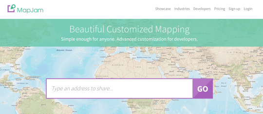
Our first and primary reason for launching MapJam in 2012 was that annotating, enhancing, sharing, and publishing personalized maps was just too difficult for non-technical people. Want a map with nice markers (not just the standard little red Google dots)? Maybe some annotated popups with images? You’d have to hire a front-end developer to do it for you with JavaScript, involve a designer to make it look good, host a page, and test it on several hardware form factors to make sure it was responsive and looked good. We’ve eliminated all of that, and built a platform for anyone to create and publish a custom map to meet their specific need or business use case.
Following the success of our UI platform, we recently launched a developer-focused service for Enterprises looking for a solid, affordable OSM tile service for site-wide maps implementations.
The best part is that hand-crafted maps from the UI can be placed side-by-side with programmatically-created maps, and nobody can really tell the difference.
What we’ve learned in chatting with larger organizations is that they were looking for total simplicity in development options, a range of creative and branding options, and most of all, simplicity in terms and pricing.
3. Maps on the web, in most countries, is synonymous with Google Maps. Why are people looking for an alternative, and what sort of feedback do you get about OSM specifically?
Talking to larger Websites and Enterprise customers, we found that Google Maps are very expensive if you achieve real volume and have to contract for a Premium plan. Have an Enterprise application, a site behind a paywall or firewall, or involved in transportation and logistics? Then regardless of volume, you’ll have to step into a Google Premium license.
Needless to say, companies are open to Google alternatives based on pricing alone, but the feedback we get most about OpenStreetMaps is that many people simply aren’t aware that it exists, or if they have heard of it, they don’t yet appreciate the quality the project has achieved.
There is good news, however. When we show sales prospects MapJam’s OSM maps side-by-side with Google with the logos hidden, there’s an “AH HA” moment of acknowledgement that there indeed is a viable alternative.
4. Lots of people in the OSM community spend lots of time on maps, thinking about geo topics, etc. But your target market seems to be very much about people who really want a simple, straight-forward solution to the standard use case of putting a few pins on a map. Can you talk a bit about that divide?
First, let’s look at Wikipedia. There’s a super dedicated army of editors, fact checkers, and subject matter experts on hand to evaluate edits and new postings. This is what makes it amazing. But the typical Wikipedia reader just wants to get the information! “What’s the population of X”, “when was Y born”, “how many wives has Z had?” That’s not a divide – that’s a dedicated group providing a real service, and an audience that is curious and has an easy way to find the information they’re looking for.
We look at the OSM community and our audience in the same way. OSM has a wonderful band of people who are considering and debating every minutia and detail into what needs to go into excellent mapping products. We were floored at the Seattle State of the Map conference by the volunteers who were organizing trips to Africa to help communities literally put themselves on the map for the first time, and the corporates who were diving into advanced machine techniques to improve the maps.
MapJam is the platform that helps makes these great maps accessible to the masses of people who need to share location information on a map, without having to understand how maps are made. Our UI (MapJam for non-developers) lets people add pins to a map, add additional contextual context to the map (opening hours, web links), and even rich media to help tell a story with photos and videos.
The platform is used by thousands of marketers, journalists, real estate agents, event organizers and just everyday people. We’ve made it really easy to share on social media and Slack, or embed on a website, or on platforms like Weebly, Shopify, Eventbrite, or Slack.
The MapJam app on Weebly, in fact, in just a matter of months, has achieved over 5,000 users, and thousands of OpenStreetMap maps grace their users’ pages.
With this success, we decided the developer market needed simplicity as well, so a few months ago we released our developer platform, which offers OSM vector tiles with advanced customization and functionality. You can style and skin maps in any way with just a couple of lines of Javascript, and we’ve got a great libraries for, yes markers, which we believe deserve better than little red or blue dots, and should in fact be a part of the story telling.
5. Our standard final question: in 2014 OSM celebrated its 10th birthday. Where do you think the project will be in 10 years time, both globally and in terms of usage by consumer services?
It’s hard to predict 10 years into the future. Who would have thought 10 years ago that maps would be so critical to whole new industries such as ridesharing, autonomous vehicles, and drones?
But taking those as lead themes, at some point soon most of the world’s streets will be mapped, as will more and more terrain. With the introduction of autonomous vehicles, IoT devices, better and more readily available cellular bandwidth and improved mobile devices, we’ll see OSM high definition mapping. In addition to satellite traces, active OSM contributors will place devices on their cars and bikes to create a new mass of information that commercial vendors will not be able to match, and with much farther geographical reach than is commercially feasible, or in undeveloped countries, simply not commercially interesting.
We’ll also start to see more detail around structures. Beyond a simple building trace, expect to see entries and exits to those buildings, as well as context of those points (e.g., employee entrance vs. shipping and receiving vs. wheelchair accessible.)
So, here’s to the next 10 years, we’re very excited to be part of this incredible mapping community and movement!
Congrats on your progress guys. Great to see more and more businesses joining in the project of bringing open geo data to the consumer via the path of solving a basic consumer need. I look forward to tracking your progress.
You can see all the Open Geo interviews here. If you are or know of someone we should interview, please get in touch, we’re always looking to promote people doing interesting things with open geo data.