Our interview series profiling OpenStreetMap communities around the world continues - today we chat with Stephane Branquart about OpenStreetMap in Morocco.
1.Who are you and what do you do? What got you into OpenStreetMap?
We are a loose association of experts (web, Geosys) and teachers. Moroccans and Europeans based in Morocco, we got together to setup a formal association numbering ten of us. With local supporters we reach around thirty.
This is few (Someone ;-) said : We few, we happy few, we band of brothers) but it’s enough to draw a roadmap showing that a free and open for all cartography can pave the way for Morocco to have a mainframe server and enable government institutions to understand and make good use of “OpenStreetMap”
What motivated us are the social and economic opportunities the project entitles: to develop a shared data-base useful to professionals involved in software designs and entice citizens and institutions to crowdsourcing and join-work (Crowdsourcing + Opendata)
This goes very much against local customs. It is precisely where OSM can effectively run against the prevailing local trend: when we explain that everyone can participate in its design, the obvious answer is to pretend it won’t work, when it actually works, right ?.
Once building up trust and sense of responsibility, everything is possible, which does not mean all problems are resolved, even on “Open”. For us there is no doubt the OSM model is the obvious solution (a “booster”) to solving the basic mapping of Morocco’s cartography which is still in it’s infancy.
2. What would you say is the current state of OSM and the OSM community in Morocco?
This community is small and not well organised. There are about between 50 to 70 active contributors based in Morocco who make frequent changes. However, a few contributors, most of them living abroad, perform a considerable amount of work such as town and road services, buildings, from satellite imaging, or once they come to visit Morocco.
From our part, during tours in the field we thrive on setting up educational initiatives, coming from students among others.
The same applies for the map, as its data display is comparable to Google’s. You’ll find basic data base. One can orientate himself but if you focus on big cities, the data is incomplete for processing, there are no buildings and quality and density of POIs is quite variable.
When reaching medium-size cities, everything is to be done. In the countryside as well. The same applies to national networks. In short, it is a huge open field.
3. What are the unique challenges and pleasures of OpenStreetMap in Morocco?
We need to create incentives for urban and rural districts and consolidate the main server in Morocco: a Moroccan map with Arabic language data, with adaptation layers to local topography, proper to the Medina’s (traditional housing quarters) specific characters, its resources and field of activities such as its craft industry.
There is an important amount of work to do on tags as well. Once we will have advanced on this groundwork, more field activities workshops will be implemented.
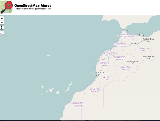
See our project here : www.openstreetmap.ma
4. What aspects of the projects should the rest of the world be aware of?
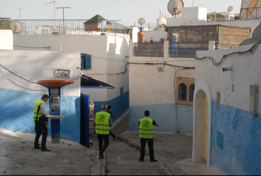
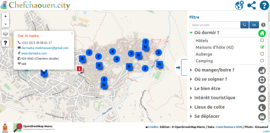
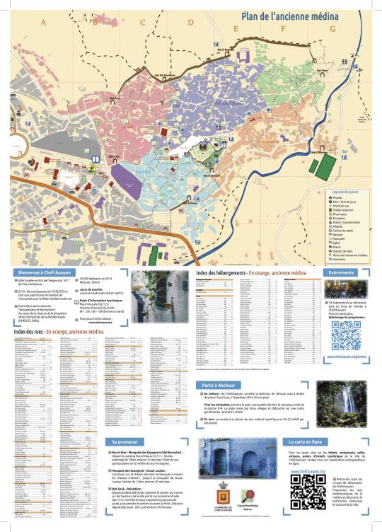
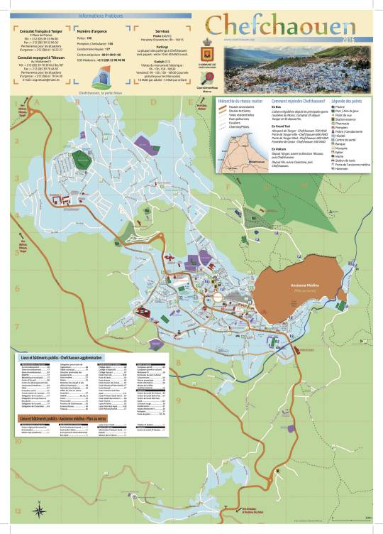
The work we have carried out on the city of “Chefchaouen” , for instance, deserves to be known (See Web Map at www.chefchaouen.city). It shows on a general basis what can be done at territory level and is a good defence to us at a local level. It also pays off to publicise it. This work is inspiring, in Morocco and elsewhere. We are now doing the same kind of job in Taliouine, a very small town down in the south.
Paper Map that will be soon printed by the town hall:
5. This is our first interview with an OSM community in the Arab world. How is OSM perceived in that community and is there much collaboration across the various countries?
We do not have any knowledge of it, at that stage, since we have no contacts. We witness an interesting trend, as well as we have a closer relationship with Sub-Saharan organisations. We had the opportunity to travel to Tunis, invited by “CarteOng”, but unfortunately no one of our staff was available at that time to make the trip.
6. Morocco is an interesting case with the disputed status of Western Sahara. How does this play out in OSM?
What is at stake here is very important to us. Our standpoint is unambiguous. There is only one Morocco and it includes the Western Sahara. We are aware this is not an opinion shared internationally by all, to this day. At that level our organisation is clear. The OSM.org map shows one standpoint, not THE standpoint.
With OSM one can express any political mapping desired that will be the result of all the world geo-localized data that is permanently updated. We are a Moroccan association contributing to enlarge all available data and we put in place a map called openstreetmap.ma. That is the only one we can and wish to work with.
7. What steps could the global OpenStreetMap community take to help support OSM in Morocco?
Take over from our work and perhaps help with the server. We have received support from OSM France, but this is a temporary solution. We are still looking for a sponsor to consolidate our setup, and we would rather look for a local one, but we could also team up sponsoring: this a pressing request !! It actually could be very enriching to organise a “state of the map 2017” in Morocco.
8. In 2014 OSM celebrated its 10th birthday, where do you think the project will be in 10 years time, both globally and in Morocco specifically?
OSM was founded on an active participation basis, self-willed and not passive at all (captors and private oriented) there is, however, an obvious unbalance of power and our future is uncertain. In Morocco, the political world will soon have to commit themselves with regards to Open. And they are quite behind schedule. But if we measure the progress made by OSM from 2004 and 2016, one can be optimistic.
The world’s complexity is now reaching a globalization level and this pulls us towards a closer collaboration from all sides as well as data sharing for permanent update.
I therefore think this pattern is going to increase and that Morocco, as other African countries, will definitely make the leap.
Great stuff Stephane! Thanks for the detailed answers and pictures. Many thanks to you and everyone else in the OSM Morocco community. Anyone wishing to learn more should follow @osmmaroc on twitter or get in touch by email.
You can see all the Open Geo interviews here. If you are or know of someone we should interview, please get in touch, we’re always looking to promote people doing interesting things with open geo data.