Next up in our interview series documenting the state of OpenStreetMap around the world is a very interesting new project. Mapazonia is focused on the massive mapping the Amazon rainforest, a territory spanning many different countries.
1. Who are you and what do you do? What got you into OpenStreetMap?
Mapazonia is a initiative of the Latin American OpenStreetMap community to coordinate collaborative mapping of the Amazon region. All mapping is done remotely, so anyone with internet access and a computer can give a contribution. First, we are mapping rivers and roads, and we plan to map forest coverage in a second stage. We are using OpenStreetMap because it is open, but also it has great tools to coordinate the work and has access to satellite imagery of the region.
2. What would you say is the current state of OSM and the OSM community in the Amazon?
Mapazonia is the first effort to create a organized OSM community for the Amazon. The region is sparsely mapped when compared to other areas, mostly because it is not densely populated and has precarious internet access.
Why do we need an effort specifically to map the Amazon?
Because we believe that an open and detailed map of the Amazon will help efforts of fighting deforestation and other environmental and socioeconomic issues. Local communities, nonprofit organizations working in the area and even the government can use this data to have a better understanding of the region and do a more effective job taking care of the forest.
3. What are the unique challenges and pleasures of OpenStreetMap in the Amazon? What aspects of the projects should the rest of the world be aware of?
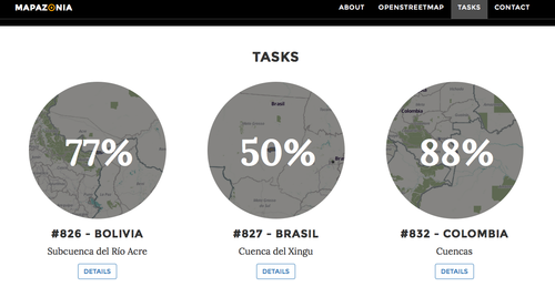
We are aiming to map 5,5 million square kilometers (the size of the Amazon rain forest), a monumental task. Mapping rivers and roads in OpenStreetMap is the fun part. The big challenge is to engage a sufficient number of people to map such huge area. In the beginning the community choose some areas in Bolivia, Brazil and Colombia and uploaded their limiting polygons to a tool called Tasking Manager. It allows splitting the polygons into pieces small enough a mapper could map in less then a hour. The mapper can lock a area, edit in his favorite tool and then mark the piece as complete in Tasking Manager. Other mappers may verify if it is mapped correctly and mark as “revised”. We are mapping little by little, trying to maintain a good level of quality.
4. What is the best way to get involved? Are you looking for remote support or trying to get locals as your primary mappers?
All work is done remotely now, so anyone with an OpenStreetMap account can help. For beginners, I recommend learning OpenStreetMap basics and also how to map rivers and roads. Experienced users can go directly to the task page, select one tile and start mapping. We recommend the contributors to subscribe to the talk-latam mailing list, where we discuss the project.
5. What steps could the global OpenStreetMap community take to help support OSM in the Amazon specifically and rural areas generally?
The most effective way to help (besides mapping) is organizing mapping parties specifically for Mapazonia. As I said, the big challenge is to have sufficient people to map this huge area, and mapping parties are great in raising awareness and training people to use OpenStreetMap. It is hard to say what the best way of mapping rural areas, but it is very important that the initiative has some appeal to potential mappers and good documentation on how to contribute.
6. OSM recently celebrated its 10th birthday, where do you think the project will be in 10 years time, both globally and in the Amazon specifically?
OpenStreetMap is reaching 2 million registered users and is growing fast. I think in ten years OSM will be the most detailed map of the Earth, open or closed.
Many thanks to the Mapazonia team for sharing this update, and thanks to everyone for their efforts on this great project. Good luck!
- Ed
You can see all the Open Geo interviews here. If you are or know of someone we should interview, please get in touch, we’re always looking to promote people doing interesting things with open geo data.